

Odette further intensifies, Signal No. 3 raised over 8 areas
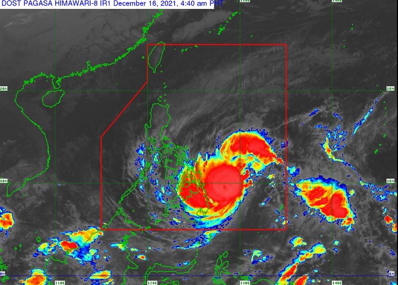
Typhoon Odette further intensifies on Thursday as it continues to approach the vicinity of the Dinagat Islands and Surigao provinces, according to the 5 a.m. Tropical Cyclone Bulletin posted by PAGASA.
As of 4 a.m., the center of the Typhoon Odette was estimated based at 330 kilometers east of Surigao City, Surigao del Norte packing maximum sustained winds of 150 kilometers per hour near the center with gustiness of up to 185 kph, and central pressure of 955 hPa.
Odette is presently moving in the west northwest at the speed of 25 kph.
Tropical Cyclone Wind Signal (TCWS) No. 3 is hoisted over the following areas:
Visayas
- Southern Leyte
- the southern portion of Leyte (Abuyog, Mahaplag, City of Baybay, Inopacan, Hindang, Hilongos, Bato, Matalom, Javier)
- Bohol
- the eastern portion of Cebu (Lapu-Lapu City, Cordova, Carmen, Danao City, Compostela, Liloan, Consolacion, Mandaue City, Cebu City, City of Talisay, Minglanilla, City of Naga, San Fernando) including Camotes Islands
Mindanao
- Dinagat Islands
- Surigao del Norte
- the northern portion of Agusan del Norte (Tubay, Santiago, Jabonga, Kitcharao)
- the northern portion of Surigao del Sur (Carrascal, Cantilan, Madrid, Carmen, Lanuza, Cortes)
TCWS No. 2 is raised over the following areas:
Luzon
- Mainland Masbate
- Ticao Island
- Romblon
- Cuyo Islands
Visayas
- Northern Samar
- Eastern Samar
- Samar
- Biliran
- the rest of Leyte
- the rest of Cebu including Bantayan Islands
- Negros Oriental
- Negros Occidental
- Siquijor
- Guimaras
- Iloilo
- Antique
- Capiz
- Aklan
Mindanao
- the rest of Surigao del Sur
- the rest of Agusan del Norte
- Agusan del Sur
- the northern portion of Bukidnon (Malitbog, Impasug-Ong, Manolo Fortich)
- Misamis Oriental
- Camiguin
- the extreme northern portion of Misamis Occidental (Sapang Dalaga, Baliangao, Plaridel, Calamba, Lopez Jaena, Oroquieta City)
- the extreme northern portion of Zamboanga del Norte (Dipolog City, Dapitan City, Sibutad, Rizal)
TCWS No. 1 is raised over the following areas:
Luzon
- Catanduanes
- Camarines Norte
- Camarines Sur
- Albay
- Sorsogon
- Burias Island
- Marinduque
- the southern portion of Quezon (San Antonio, Tiaong, Candelaria, Sariaya, Dolores, Lucena City, Pagbilao, Padre Burgos, Atimonan, Agdangan, Unisan, Gumaca, Plaridel, Pitogo, Lopez, Guinayangan, Buenavista, Catanauan, General Luna, Macalelon, Mulanay, San Narciso, San Andres, San Francisco, Tagkawayan, Calauag, Quezon, Alabat, City of Tayabas, Perez)
- Batangas
- Oriental Mindoro
- Occidental Mindoro
- the northern and central portions of Palawan (San Vicente, Roxas, Taytay, Dumaran, Araceli, El Nido, Puerto Princesa City, Quezon, Narra, Sofronio Española, Aborlan) including Calamian, Cagayancillo and Kalayaan Islands
Mindanao
- the northern portion of Davao Oriental (Baganga, Cateel, Boston)
- the northern portion of Davao de Oro (Laak, Mawab, Nabunturan, Montevista, Monkayo, New Bataan, Compostela)
- the northern portion of Davao del Norte (Talaingod, Santo Tomas, Kapalong, Asuncion, San Isidro, New Corella)
- the rest of Misamis Occidental
- the rest of Bukidnon
- Lanao del Norte
- Lanao del Sur
- the northern portion of Zamboanga del Norte (Labason, Kalawit, Tampilisan, Liloy, Salug, Godod, Bacungan, Sindangan, Siayan, Jose Dalman, Manukan, Pres. Manuel A. Roxas, Katipunan, Sergio Osmeña Sr., Polanco, Piñan, Mutia, La Libertad, Gutalac, Baliguian)
- the northern portion of Zamboanga del Sur (Bayog, Lakewood, Kumalarang, Guipos, Mahayag, Dumalinao, Tukuran, Tambulig, Ramon Magsaysay, Aurora, Molave, Sominot, Tigbao, Labangan, Josefina, Pagadian City, Midsalip, Dumingag)
- northern portion of Zamboanga Sibugay (Titay, Ipil, Naga, Kabasalan, Siay, Diplahan, Buug)
On Thursday, PAGASA reported that due to the typhoon there will be heavy to torrential rains Caraga, central Visayas, Misamis Oriental, Camiguin, Southern Leyte, and Negros Occidental.
Moderate to heavy with at times intense rains over Leyte, the southern portions of Eastern Samar and Samar, Zamboanga del Norte, Lanao del Sur, and the rest of Northern Mindanao.
Light to moderate with at times heavy rains over Bicol Region, Davao Oriental, Davao de Oro, Davao del Norte, Quezon, and the rest of Visayas, Zamboanga Peninsula, and mainland Bangsamoro.
Severe Winds
Residents within areas under TCWS No. 3 are expected to experience destructive typhoon-force winds while damaging winds reaching gale- to storm-force strength will be experienced within any of the areas under TCWS No. 2 and strong winds, strong breeze to near gale, with higher gusts will be experienced within any of the areas where TCWS No. 1.
Coastal Inundation
There is a moderate to high risk of storm surge of up to 3.0 m in height which may cause flooding in the low-lying coastal areas of Central Visayas, Iloilo, Guimaras, Negros Occidental, Eastern Samar, Southern Leyte, Dinagat Islands, Surigao del Norte, Surigao del Sur, and several localities in the northern portion of Palawan including Calamian, Cuyo and Cagayancillo Islands, Antique, Camiguin, Leyte, Agusan del Norte, and Davao Oriental.
FORECAST AND TRACK
Typhoon Odette will continue moving generally westward over the Philippine Sea and the center of its eye is forecast to make landfall in the vicinity of Dinagat Islands, Siargao-Bucas Grande Islands, or the northern portion of Surigao del Sur this afternoon.
The public and disaster risk reduction and management offices concerned are advised to take all necessary measures to protect life and property. For residents living in areas identified as susceptible to landslides and other hazards are advised to follow evacuation protocols. -- BAP, GMA News
