

Signal 2 up over 4 areas as Agaton moves slowly over Leyte Gulf —PAGASA
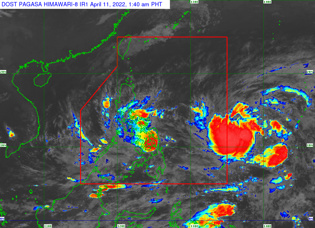
Tropical Storm Agaton continues to move "very slowly" over Leyte Gulf and is expected to make landfall over the eastern coast of Leyte "within the next several hours," PAGASA said in its 2 a.m. update on Monday.
According to the weather bureau, as of 1 a.m. the tropical storm's center was over the coastal waters of Tolosa, Leyte, with maximum sustained winds of 65 km/h near the center, gustiness of up to 90 km/h, and central pressure of 998 hPa.
It added that Agaton is slowly moving westwards with strong winds or higher that extend outwards up to 180 km from the center.
It is expected to "meander" over the vicinity of the northern portion of Leyte, the southern portion of Samar, Biliran, and the coastal waters of these areas throughout Monday.
By Tuesday afternoon or evening, the weather bureau expects Agaton to make a gradually accelerating turn east-southeast, or east, as it interacts with an incoming tropical cyclone with the international name Malakas.
The following areas are under Tropical Cyclone Wind Signal (TCWS) No. 2:
- the southern portion of Eastern Samar (Quinapondan, Giporlos, Balangiga, Lawaan),
- the southern portion of Samar (Daram, Zumarraga, Villareal, Talalora, Santa Rita, Pinabacdao, Basey, Marabut),
- Biliran,
- the northern and central portions of Leyte (Abuyog, Javier, Macarthur, Burauen, Mayorga, La Paz, Julita, Dulag, Tolosa, Tanauan, Palo, Tacloban City, Santa Fe, Babatngon, San Miguel, Alangalang, Pastrana, Tabontabon, Dagami, Jaro, Carigara, Tunga, Barugo, Capoocan, Leyte, Calubian)
These areas have gale-force winds prevailing or may expect within the next 24 hours. Winds may also result in minor to moderate threats to life and property, PAGASA said.
Meanwhile, TCWS No. 1 is raised over:
- the southern portion of Masbate (Dimasalang, Palanas, Cataingan, Pio V. Corpuz, Esperanza, Placer, Cawayan)
- the rest of Eastern Samar,
- the rest of Samar,
- Northern Samar,
- the rest of Leyte,
- Southern Leyte,
- the northeastern portion of Cebu (Daanbantayan, Medellin, Bantayan Islands, Bogo City, San Remigio, Tabogon, Borbon, Tabuelan, Sogod, Catmon, Carmen, Danao City, Compostela, Liloan, Tuburan, Asturias) including Camotes Island,
- the eastern portion of Bohol (Buenavista, Danao, Dagohoy, Pilar, Guindulman, Candijay, Mabini, Alicia, Ubay, San Miguel, Pres. Carlos P. Garcia, Trinidad, Bien Unido, Talibon, Jetafe)
- Surigao del Norte,
- Dinagat Islands
Strong winds prevailing or are expected in these areas within the next 36 hours. Winds may also result in minimal to minor threat to life and property.
Storm Agaton made landfall over Calicoan Island in Guiuan at 7:30 a.m.
"Moderate to heavy with at times intense rains over Eastern Visayas, Masbate, Sorsogon, Catanduanes, and the northern and central portions of Cebu including Bantayan and Camotes Islands. Light to moderate with at times heavy rains over Dinagat Islands, Oriental Mindoro, Marinduque, Romblon, and the rest of Bicol Region and Visayas" may be expected on Monday, PAGASA said.
In the next 24 hours, rough to very rough seas (2.8 to 5.0 m) will prevail over the seaboards of areas where TCWS No. 2 and TCWS No. 1 are hoisted.
Moreover, moderate to rough seas (1.2 to 3.4 m) will also prevail over the remaining seaboards of the country that are not under any wind signal or gale warning. —LBG/DVM/BM, GMA News
