

Rosal maintains strength, accelerates from east of extreme northern Luzon
Tropical Storm Rosal (international name: Pakhar) on Monday maintained its strength and accelerated going east northeast, state weather bureau PAGASA said.
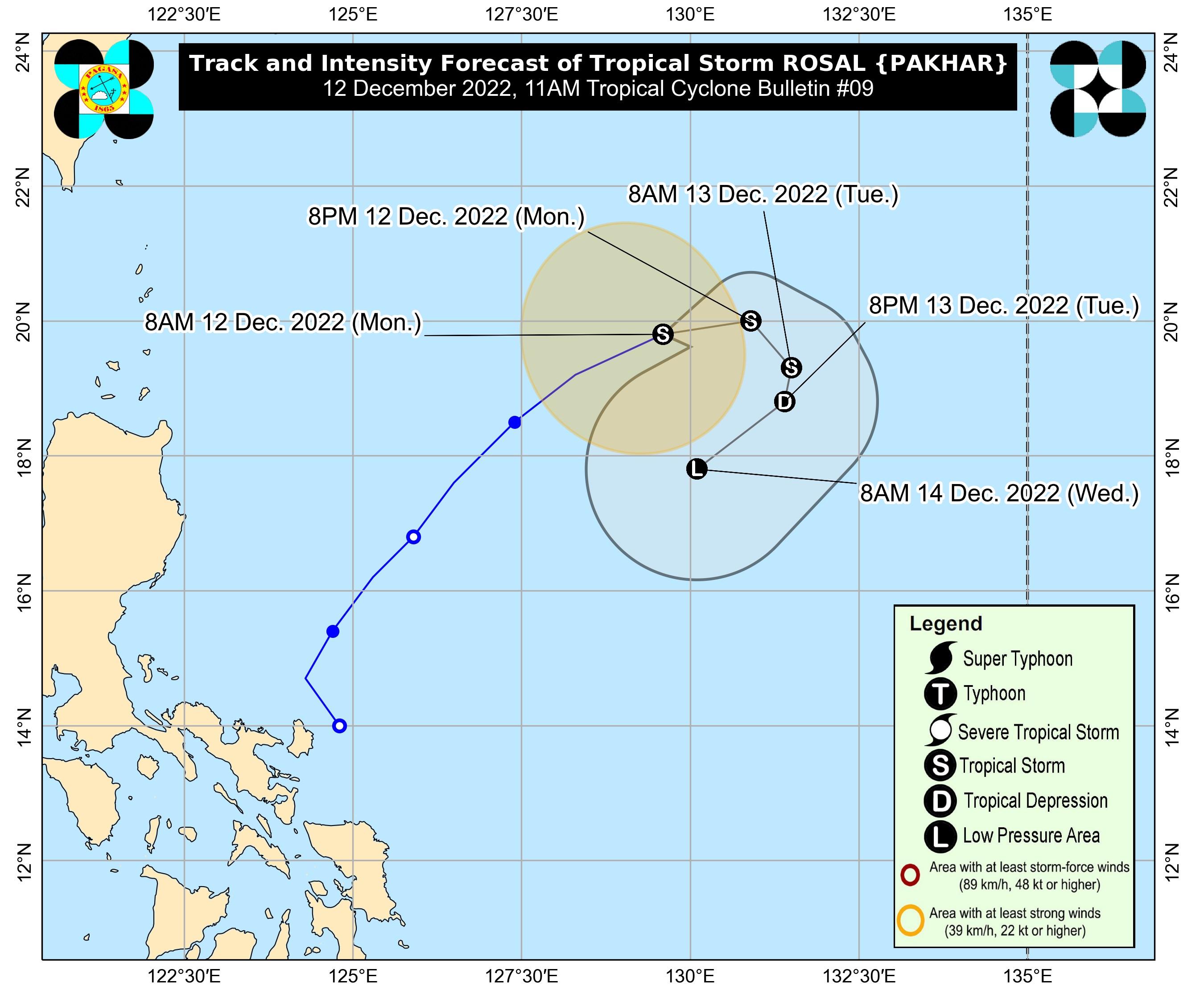
In its 11 a.m. bulletin, PAGASA said Rosal, located at 860 kilometers east of extreme northern Luzon, was moving at 25 km per hour with maximum sustained winds of 85 km/h and gustiness of up to 105 km/h.
Rosal is less likely to directly bring heavy rains in the country throughout the forecast period, according to PAGASA.
No Tropical Cyclone Wind Signal was raised in any parts of the country.
However, the surge of the Northeast Monsoon partly enhanced by Rosal may bring occasional gusts reaching gale-force winds over Batanes, PAGASA said.
It may also bring strong breeze to near-gale strength winds over Babuyan Islands, and the coastal and upland areas of Ilocos Norte, northern and eastern Cagayan, and eastern Isabela, it added.
A marine gale warning is in effect over the seaboards of Northern Luzon, according to PAGASA.
Due to the Northeast Monsoon and Rosal, moderate to rough seas up to 3.5 meters are expected over the seaboards of Central Luzon and the eastern seaboard of Southern Luzon.
“These conditions may be risky for those using small seacraft. Mariners are advised to take precautionary measures when venturing out to sea and, if possible, avoid navigating in these conditions,” PAGASA said.
Rosal is expected to move east northeastward within the next six hours before moving generally eastward the rest of the day.
According to PAGASA, the tropical storm has already reached its peak intensity and may begin to weaken Monday afternoon or evening.
“Rosal is forecast to become a remnant low [pressure area] tomorrow late evening or on Wednesday early morning before dissipating shortly thereafter,” PAGASA said. —Joviland Rita/KG, GMA Integrated News
