

LPA, ITCZ to bring scattered rains over Mindanao, Eastern, Central Visayas
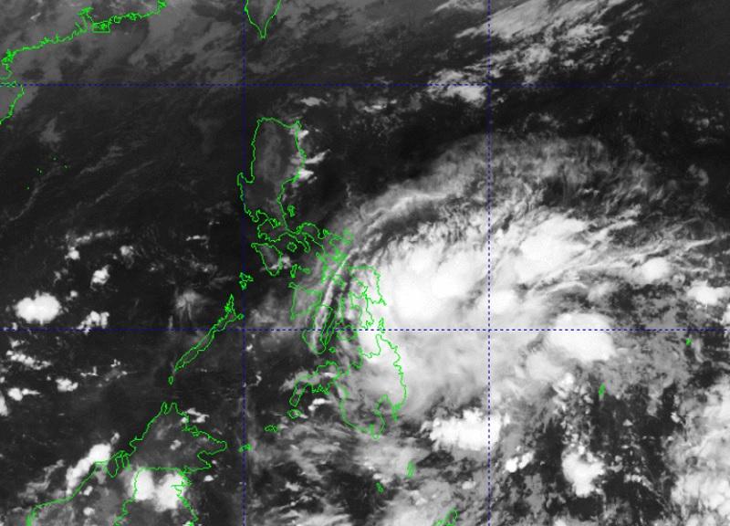
A Low Pressure Area (LPA) embedded along the Intertropical Convergence Zone (ITCZ) affecting Mindanao and Palawan, and the easterlies affecting the rest of the country will bring rain showers on Tuesday, PAGASA said in its weather forecast.
At 3 a.m. on Tuesday, the LPA was estimated to be located at 490 kilometers east of Davao City.
Mindanao, Eastern Visayas, and Central Visayas will have cloudy skies with scattered rain showers and thunderstorms due to the ITCZ and LPA. Flash floods or landslides may result due to moderate with at times heavy rains.
Metro Manila and the rest of the country will have partly cloudy to cloudy skies with isolated rain showers or thunderstorms due to the easterlies and localized thunderstorms. Flash floods or landslides may occur, the weather bureau said, during severe thunderstorms.
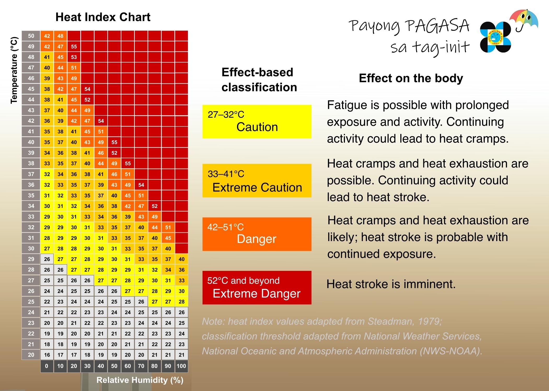
The forecasted Heat Index for Metro Manila ranges from a minimum of 40 degrees Celsius to a maximum of 43 degrees Celsius.
The heat index is the measure of the temperature that a person feels in contrast to the actual air temperature.
Visayas and Mindanao will experience light to moderate wind speed moving in the northeast to north direction while coastal waters will be slight to moderate.
Luzon will experience light to moderate wind speed moving in the east to northeast direction while coastal waters will be slight to moderate.
Sunrise will be at 5:33 a.m., sunset at 6:13 p.m. —BAP/KG, GMA Integrated News
