

Betty downgraded to typhoon, continues to move over Philippine Sea
Weather bureau PAGASA has downgraded Betty to a typhoon as it continues to move over the Philippine Sea.
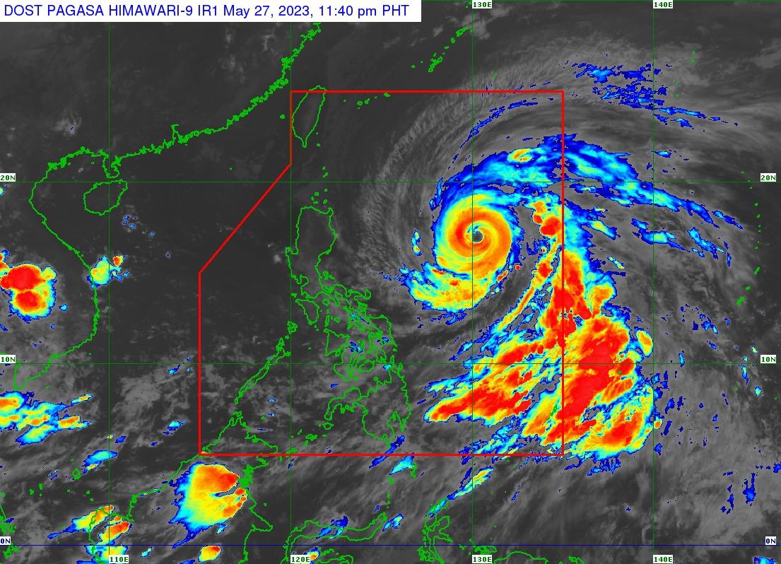
As of 10 p.m., the center of Betty was located 895 kilometers east of Central Luzon or 935 kilometers east of Northern Luzon, carrying maximum sustained winds of 175 km/h near the center and gustiness of up to 215 km/h, PAGASA said in its 11 p.m. bulletin.
It was moving westward at 25 km/h.
PAGASA said the following areas were placed under Signal No. 1:
1. Batanes
2. Cagayan including Babuyan Islands
3. Isabela
4. Apayao
5. Ilocos Norte
6. the northern and central portions of Abra (Tineg, Lacub, Lagayan, San Juan, Lagangilang, Licuan-Baay, Malibcong, Danglas, La Paz, Dolores, Tayum, Bucay, Sallapadan, Daguioman, Bucloc, Boliney)
7. Kalinga
8. the eastern and central portions of Mountain Province (Sadanga, Barlig, Natonin, Paracelis, Bontoc)
9. the eastern and central portions of Ifugao (Mayoyao, Aguinaldo, Alfonso Lista, Banaue, Hingyon, Lagawe, Lamut, Kiangan, Asipulo)
10. the northern and central portions of Aurora (Dilasag, Casiguran, Dinalungan, Dipaculao)
11. Quirino
12. the northeastern portion of Nueva Vizcaya (Kasibu, Quezon, Solano, Bagabag, Diadi, Villaverde, Bayombong, Ambaguio)
The forecast accumulated rainfall from Sunday evening to Monday evening was 50 to 100 millimeters in Batanes, the Babuyan Islands, and the northern portion of mainland Cagayan.
Meanwhile, the forecast accumulated rainfall from Monday evening to Tuesday evening was more than 200 mm in Batanes; 100–200 mm in Babuyan Islands, the northern portion of mainland Cagayan, Apayao, Ilocos Norte, and Ilocos Sur; and 50–100 mm in La Union and the rest of the Cordillera Administrative Region.
Strong winds are possible within any of the areas where Signal No. 1 is currently in effect; such conditions may begin late Sunday or Monday.
PAGASA said the enhanced Southwest Monsoon may also bring strong breeze to near gale conditions with intermittent gusts beginning on Sunday evening or early Monday over Visayas, the eastern portion of Central Luzon, the eastern and southern portions of Southern Luzon, and the northern portion of Mindanao.
The weather bureau said the western portion of Luzon may also experience similar conditions beginning on Tuesday or Wednesday.
It said a marine gale warning is in effect over the following areas:
* the northern and eastern seaboards of Northern Luzon
* eastern seaboards of Central and Southern Luzon
* the eastern seaboards of Visayas and Mindanao
“Betty is forecast to track west northwestward or northwestward in the 72 hours while gradually decelerating,” it said.
“The typhoon will likely become slow-moving to almost stationary by Tuesday while over the waters east of Batanes. Betty will resume moving towards the north or north northeast by mid Wednesday,” it added.
“This typhoon is forecast to remain as a typhoon throughout the forecast period, although it is expected to gradually weaken until Tuesday.” — VBL, GMA Integrated News
