

Chedeng further weakens, seen to leave PAR on Sunday night; Habagat to bring rains
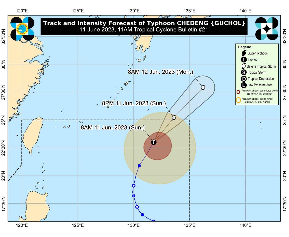
Typhoon Chedeng (international name: Guchol) has further weakened and is expected to accelerate northeastward and leave the Philippine Area of Responsibility (PAR) on Sunday night, PAGASA said in a bulletin.
At 10 a.m., the center of Chedeng was located at 1,100 km east northeast of Extreme Northern Luzon, PAGASA said.
Chedeng has maximum sustained winds of 120 km/h near the center, gustiness of up to 150 km/h, and central pressure of 975 hPa.
Its present movement is north northeastward at 25 km/h, and brings strong to typhoon-force winds extending outwards up to 440 km from the center.
Despite having no wind signals raised due to Chedeng, PAGASA said the enhancement of the Habagat or Southwest Monsoon over the next two days may bring gusty conditions over the following areas, especially in coastal and upland/mountainous localities exposed to winds:
Sunday: Batanes, Babuyan Islands, Ilocos Region, Cordillera Administrative Region, Nueva Vizcaya, Central Luzon, Metro Manila, Calabarzon, Mimaropa, Bicol Region, and Western Visayas.
Monday: Batanes, Babuyan Islands, Ilocos Region, Cordillera Administrative Region, Nueva Vizcaya, Central Luzon, Metro Manila, CALABARZON, Occidental Mindoro, Oriental Mindoro, Romblon, Marinduque, northern mainland Palawan, Calamian Islands, Cuyo Islands, Kalayaan Islands, Bicol Region, and Western Visayas.
PAGASA said Chedeng will continue to weaken throughout the forecast period “under increasingly unfavorable environment.”
It is also forecast to be downgraded into a severe tropical storm on Sunday.
“CHEDENG is unlikely to directly bring heavy rainfall over the country in the next 3 days. However, the Southwest Monsoon enhanced by CHEDENG will bring occasional to monsoon rains over the western portions of Luzon and Visayas in the next 3 days,” PAGASA said.
As to coastal waters, Chedeng may bring moderate to rough seas (2.0 to 3.0 m) over the seaboard of Extreme Northern Luzon in the next 24 hours.
PAGASA advised mariners of small seacrafts to take precautionary measures when venturing out to sea, or avoid navigating in these conditions if they are inexperienced or operating ill-equipped vessels. —Giselle Ombay/KG, GMA Integrated News
