

Goring slightly intensifies; Signal No. 1 over four areas
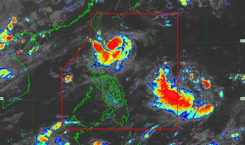
Tropical Storm Goring slightly intensified with four areas under Signal No. 1 as it moved slowly in the southwest direction, PAGASA reported early Friday morning.
As of 4 a.m., the center of Goring was estimated at 220 kilometers east southeast of Basco, Batanes packing maximum sustained winds of 75 kilometers per hour near the center, gustiness of up to 90 km/h, and central pressure of 998 hPa.
PAGASA said Goring was moving southwestward slowly with strong to gale-force winds extending outwards up to 160 km from the center.
Tropical Cyclone Wind Signal (TCWS) No. 1 was hoisted over the following areas:
- Batanes
- the eastern portion of Babuyan Islands (Babuyan Is., Camiguin Is.)
- the eastern portion of mainland Cagayan (Santa Ana, Gonzaga, Lal-Lo, Gattaran, Baggao, Peñablanca)
- the northeastern portion of Isabela (Maconacon, Divilacan, Palanan)
Hazards affecting land areas
Forecast accumulated rainfall for today from 50-100 mm for Batanes, Babuyan Islands, and the northeastern portion of mainland Cagayan.
PAGASA reported that the forecast rainfall are generally higher in elevated or mountainous areas.
"Under these conditions, flooding and rain-induced landslides are possible especially in areas that are highly or very highly susceptible to these hazards as identified in hazard maps and in localities that experienced considerable amounts of rainfall for the past several days," the bureau added.
Meanwhile, the southwest monsoon or habagat will be enhanced by Goring and bring occasional rains over the western portions of Central Luzon and Southern Luzon beginning on Friday, and over the western portion of Visayas beginning on Sunday.
Cagayan Valley, Cordillera Administrative Region, and Ilocos Region will have cloudy skies with scattered rain showers and thunderstorms due to the trough of Tropical Storm Goring. Flooding or landslides may occur in these areas due to moderate with at times heavy rains.
Palawan, Occidental Mindoro, Zambales, and Bataan will have cloudy skies with scattered rain showers and thunderstorms due to the southwest monsoon. Flooding or landslides may occur due to moderate with at times heavy rains.
Metro Manila and the rest of the country will have partly cloudy to cloudy skies with isolated rain showers or thunderstorms due to the southwest monsoon and localized thunderstorms as flash floods or landslides may occur during severe thunderstorms.
Severe Winds
Local winds may be slightly stronger/enhanced in coastal and upland and mountainous areas exposed to winds. Winds are less strong in areas sheltered from the prevailing wind direction.
The enhanced southwest monsoon will continue to bring gusty conditions over the following areas not under any Wind Signal, especially in coastal and upland/mountainous areas exposed to winds: Aurora, Bataan, Metro Manila, CALABARZON, Bicol Region, Dinagat Islands, and most of MIMAROPA and Visayas
Hazards affecting coastal waters
A Coastal Gale Warning is in effect for the coastal waters of Batanes, Babuyan, and the northern coast of mainland Cagayan due to strong winds associated with Goring which may cause sea travel to be risky for certain types or tonnage of vessels.
Track and Intensity Outlook
The tropical storm is forecast to move south southwestward or southward over the waters east of Northern Luzon until tomorrow afternoon, then turn southeastward for the rest of tomorrow through Sunday afternoon.
Goring will loop northward before turning to the northwest on Tuesday towards Luzon Strait. For the most of the forecast period, GORING is forecast to move slowly.
"Due to highly favorable environment, GORING is forecast to rapidly intensify and may reach typhoon category by tomorrow. It may reach its peak intensity on Sunday evening, after which it is forecast to maintain strength until the end of the forecast period. The potential for developing into a super typhoon is not ruled out," PAGASA reported. — BAP, GMA Integrated News
