

Signal No. 1 up over Batanes as Typhoon Hanna makes landfall in Taiwan
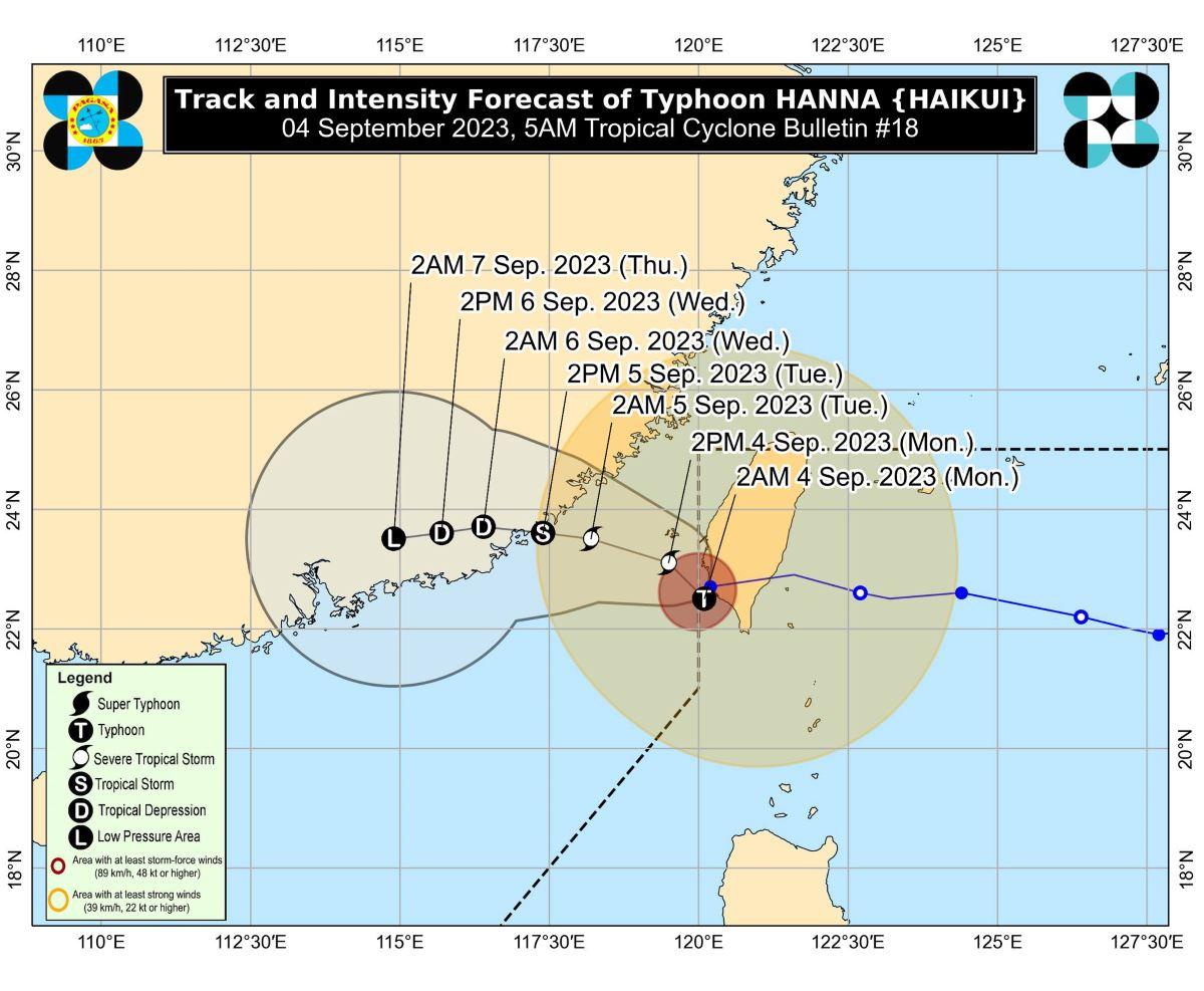
Tropical Cyclone Wind Signal (TCWS) No. 1 remained in effect over Batanes early Monday morning as Typhoon Hanna (international name: Haikui) made landfall in Kaohsiung City in Taiwan, PAGASA said in its bulletin.
At 4 a.m., the center of Hanna was estimated to be located at 265 km northwest of Itbayat, Batanes or in the vicinity of Kaohsiung City.
Hanna has maximum sustained winds of 120 km/h near the center, gustiness of up to 165 km/h, and central pressure of 975 hPa.
It is moving south southwestward slowly and erratically off the coast of southwestern Taiwan.
From Hanna's center, strong to typhoon-force winds are extending outwards up to 500 km.
Batanes will experience strong winds in 36 hours with wind speeds of 39 to 61 km/h, posing minimal to minor threat to life and property.
Hanna is expected to exit the Philippine Area of Responsibility (PAR) within the next six to 12 hours, PAGASA said.
Habagat
Meanwhile, Hanna is enhancing the Southwest Monsoon (Habagat) which will bring occasional to monsoon rains over the western portion of Luzon and Antique in the next three days.
Gusty conditions will thus be experienced in the following areas not under any TCWS, especially in coastal and upland or mountainous areas exposed to winds:
• Monday: Batanes, Babuyan Islands, Ilocos Region, Cordillera Administrative Region, Nueva Vizcaya, the southern portion of Aurora, Zambales, Bataan, Bulacan, Metro Manila, Occidental Mindoro, Romblon, Marinduque, the northern portion of Palawan including Calamian, Kalayaan, and Cuyo Islands, and most of Calabarzon, Bicol Region, and Western Visayas.
• Tuesday: Batanes, Babuyan Islands, Ilocos Region, Abra, Benguet, Nueva Vizcaya, the southern portion of Aurora, Zambales, Bataan, Bulacan, Metro Manila, Occidental Mindoro, Romblon, Marinduque, Kalayaan Islands, Camarines Provinces, and most of CALABARZON.
• Wednesday: Batanes, Ilocos Norte, the western portion of Pangasinan, and Kalayaan Islands
Coastal waters
PAGASA raised a gale warning for the seaboards of Northern Luzon, the western and southern seaboards of Luzon, and the western seaboard of Visayas
This is due to the combined influence of Hanna and the Southwest Monsoon.
Track, intensity outlook
Hanna is expected to weaken into a severe tropical storm in the next six to 12 hours due to the interaction with Taiwan's rugged terrain.
It will then gradually move west northwestward over the Taiwan Strait while weakening, then make landfall over the coast of Guangdong or Fujian, China on Tuesday morning or afternoon.
PAGASA advised the public and disaster risk reduction and management offices concerned to take the necessary measures to protect life and property.
The weather bureau will issue the next tropical cyclone bulletin at 11 a.m.
Classes, flights canceled
Several localities meanwhile canceled classes for Monday due to inclement weather caused by Typhoon Hanna and the Southwest Monsoon.
Some airlines also canceled their flights for Monday due to unfavorable weather condition. —KG, GMA Integrated News
