

LPA inside PAR becomes 'Auring', 1st tropical depression of 2025
The low-pressure area observed inside the Philippine Area of Responsibility developed on Thursday night into a tropical depression named Auring, the first tropical cyclone to form in the country in 2025.
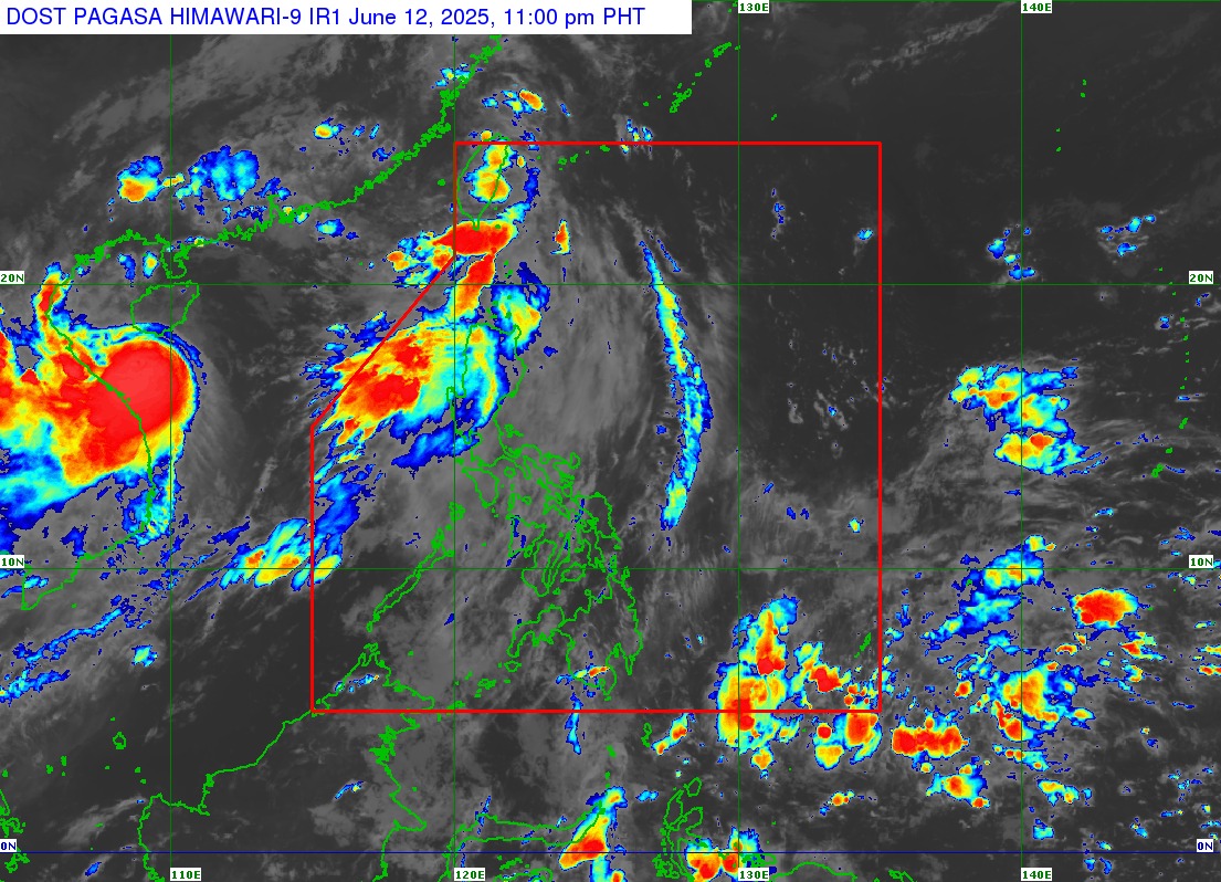
PAGASA said that the LPA became a tropical depression at 8 p.m.
As of 10 p.m., Auring was located 295 kilometers north of Itbayat, Batanes.
It was moving northwestward at 15 kph with maximum sustained winds of 45 kph near the center and gustiness of up to 55 kph.
In a heavy rainfall outlook on Auring, PAGASA said that 50 to 100 millimeters of rain are expected in Batanes and Cagayan.
"Forecast rainfall may be higher in mountainous and elevated areas. Moreover, impacts in some areas may be worsened by significant antecedent rainfall," PAGASA said.
The weather bureau warned of localized flooding, especially in urbanized, low-lying areas or those near rivers.
Landslides are also possible in susceptible areas.
"PAGASA Regional Services Division may issue Heavy Rainfall Warnings, Rainfall/Thunderstorm Advisories, and other severe weather information specific to their areas of responsibility as appropriate," PAGASA said.
It said the next weather advisory on Auring will be issued at 5 a.m. unless significant changes occur.
Effects on seas
Today through tomorrow, the Southwest Monsoon will likely bring strong to near-gale gusts over Batanes and Babuyan Islands.
Moderate to rough seas (2.5 to three meters) over the seaboards of Ilocos Region, Zambales, Batanes, and Babuyan Islands.
"Mariners of small seacrafts, including all types of motorbancas, are advised not to venture out to sea under these conditions, especially if inexperienced or operating ill-equipped vessels," PAGASA said.
Moderate seas (up to 2.5 meters) over the western seaboards of Bataan and Occidental Mindoro.
PAGASA said mariners of motorbancas and similarly-sized vessels are advised to take precautionary measures while venturing out to sea and, if possible, avoid navigation under these conditions
Forecast track
Auring is forecast to continue moving north-northwestward and may make landfall over Taiwan between Thursday night and Friday early morning.
"Due to land interaction, rapid weakening is expected and Auring may be downgraded to a low-pressure area tomorrow," PAGASA said.
PAGASA advised the public and disaster risk reduction and management offices concerned to take all necessary measures to protect life and property. –Mariel Celine Serquiña and Vince Angelo Ferreras/RF/NB, GMA Integrated News
