

LPA inside PAR still has 'medium' chance to become tropical depression —PAGASA
The low pressure area (LPA) inside the Philippine Area of Responsibility (PAR) still has a medium chance of developing into a tropical depression within the next 24 hours, state weather bureau PAGASA said on Tuesday.
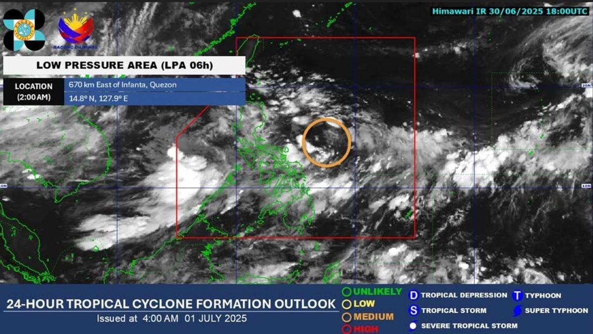
In an update around 7:30 a.m., PAGASA said that as of 2 a.m., the LPA was still being monitored near the eastern side of the country.
“As of 2:00 AM today, 01 July 2025, the Low Pressure area (LPA 6h) still being monitored inside the Philippine Area of Responsibility (PAR) and has a "MEDIUM" potential to develop into a tropical depression within the next 24 hours,” PAGASA said.
“All are advised to monitor updates from DOST-PAGASA,” it added.
The LPA at 3 a.m. was located 650 kilometers east of Infanta, Quezon, PAGASA said in an earlier report.
The trough of the LPA and the Southwest Monsoon or Habagat will bring cloudy skies with scattered rains over parts of the country on Tuesday, according to PAGASA.
Due to the trough of the LPA, cloudy skies with scattered rains and thunderstorms are expected over Metro Manila, Visayas, MIMAROPA, Zamboanga Peninsula, Northern Mindanao, Caraga, and the rest of Central Luzon and CALABARZON.
Flash floods or landslides are possible during moderate to at times heavy rains.
Two or three cyclones may be formed inside or enter PAR this month of July 2025, PAGASA said, according to a report on Unang Balita on Tuesday. —Joviland Rita/KG, GMA Integrated News
