

PAGASA: Bising now a tropical storm, further intensification possible
Tropical Depression Bising has developed into a storm, according to PAGASA as of 8 p.m. Friday.
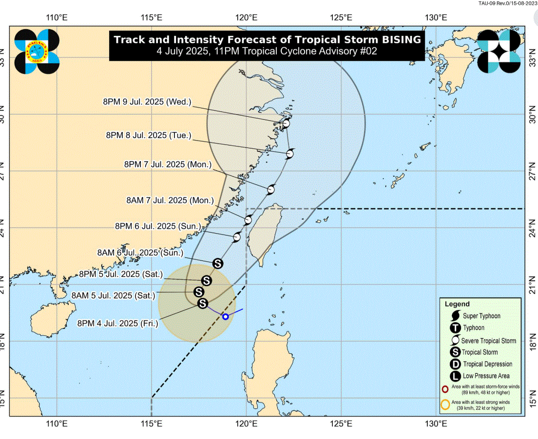
Bising, however, remains outside the Philippine Area of Responsibility (PAR) and continues to be monitored, the state weather bureau added.
In a separate weather Tropical Cyclone Advisory at 11 p.m., PAGASA said "further intensification is possible and it may reach severe tropical storm category by Sunday, July 6."
Bising was spotted 415 kilometers West Northwest of Calayan, Cagayan or 460 km West of Basco, Batanes, with maximum sustained winds of 65 kilometers per hour and gustiness of up to 80 kilometers per hour.
It is moving west northwestward at 10 kilometers per hour.
"Tropical Storm Bising is forecast to move north northwestward tonight through tomorrow morning before turning north northeastward over the sea west of Extreme Northern Luzon," PAGASA said.
"Re-entry to the western boundary of the PAR is possible by Monday (07 July) early morning and it may exit again the northern boundary of PAR on Monday afternoon," it added.
Rough seas with waves up to three meters are expected in certain coastal areas of the Philippines:
- Up to 3.0 m: The western seaboards of Babuyan Islands and Ilocos Norte
- Up to 2.5 m: The northwestern seaboard of Ilocos Sur and the seaboard of Batanes
- • Up to 2.0 m: The western seaboards of La Union and Pangasinan, the remaining seaboard of Ilocos Sur
"Mariners of motorbancas and similarly-sized vessels are advised to take precautionary measures while venturing out to sea and, if possible, avoid navigation under these conditions," PAGASA said.—LDF, GMA Integrated News
