

Signal No. 1 in Batanes as Bising intensifies, re-enters PAR
Typhoon Danas re-entered the Philippine Area of Responsibility (PAR) as Typhoon Bising, PAGASA said Sunday evening.
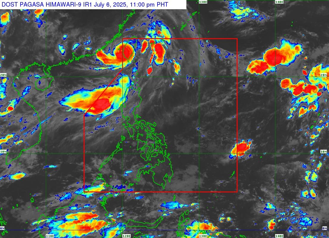
In its 11 p.m. tropical cyclone bulletin, the state weather forecaster said that Batanes remains under Signal No. 1 due to Bising—while it was still outside PAR—and that most of the Philippines is expected to experience rains also due to the Southwest Monsoon or Habagat.
In a later update, PAGASA said that Bising has re-entered PAR as of 11 p.m.
As of 10 p.m., the center of the eye of Bising was estimated to 335 km northwest of Itbayat, Batanes outside PAR. It is moving northeast at 20 km/h with maximum sustained winds of 150 kn/h near the center, gustiness of up to 185 km/h, and central pressure of 965 hPa.
The Habagat and the periphery of Bising are also forecast to bring strong to gale-force gusts to the Ilocos Region, Cagayan, Isabela, Aurora, Zambales, Bataan, Quezon, Occidental Mindoro, Masbate, and Romblon on Monday, "especially in coastal and upland areas exposed to winds," said PAGASA.
Some areas have already suspended Monday classes in anticipation of the weather.
After re-entering PAR very late on Sunday, Bising is then seen to cross the Taiwan landmass and its center will leave the northern boundary of PAR Monday morning, and eventually be 720 kilometers north northwest of Itbayat, Batanes or in the vicinity of Fujian, China on Wednesday morning.
In its separate rainfall advisory, PAGASA said light to moderate rains are expected over Bulacan, Nueva Ecija, Pampanga, and Tarlac, which will affect Zambales and Bataan.
Rainfall Advisory No. 2 #NCR_PRSD
— PAGASA-DOST (@dost_pagasa) July 6, 2025
Weather System: Southwest Monsoon (Habagat)
Issued at: 11:00 PM, 06 July 2025(Sunday)
Light to moderate rains are expected over Pampanga, Tarlac, Bulacan and Nueva Ecija.
Light to moderate rains affecting Zambales and Bataan.
The public and the… pic.twitter.com/XCEN4ffu0C
— Jon Viktor D. Cabuenas/BM, GMA Integrated News
