

Crising slightly intensifies as 10 areas under Signal No. 2
Tropical Cyclone Wind Signal (TCWS) No. 2 is hoisted over 10 areas in Luzon as Tropical Storm Crising slightly intensified approaching Cagayan and Babuyan Islands, state weather bureau PAGASA said Friday.
In its 11 a.m. bulletin, PAGASA said the following areas are under TCWS No. 2:
- Batanes
- Cagayan including Babuyan Islands
- Isabela
- Apayao
- Kalinga
- the northern and central portions of Abra (Manabo, Pidigan, San Juan, Tayum, Langiden, Boliney, Sallapadan, Bucloc, Lagangilang, Danglas, La Paz, Licuan-Baay, Tineg, Malibcong, Peñarrubia, San Isidro, Daguioman, San Quintin, Dolores, Lagayan, Bangued, Bucay, Lacub)
- the eastern portion of Mountain Province (Natonin, Paracelis)
- the eastern portion of Ifugao (Aguinaldo, Alfonso Lista)
- Ilocos Norte
- the northern portion of Ilocos Sur (Cabugao, Sinait, Magsingal, San Juan, San Ildefonso, Santo Domingo, Bantay, San Vicente, Santa Catalina, Caoayan, City of Vigan, Santa)
TCWS No. 1 is raised in the following areas:
- Quirino
- Nueva Vizcaya
- the rest of Mountain Province
- the rest of Ifugao
- the rest of Abra
- Benguet
- the rest of Ilocos Sur
- La Union
- the northern portion of Pangasinan (San Nicolas, Natividad, San Quintin, San Manuel, Tayug, Sison, San Fabian, Pozorrubio, Laoac, Binalonan, San Jacinto, Manaoag, Mangaldan, Dagupan City, Binmaley, Lingayen, Labrador, Sual, City of Alaminos, Bolinao, Anda, Bani, Agno, Burgos, Mabini, Dasol, Calasiao, Santa Barbara, Mapandan, Bugallon)
- the northern portion of Aurora (Dilasag, Casiguran, Dinalungan, Dipaculao, Baler, Maria Aurora)
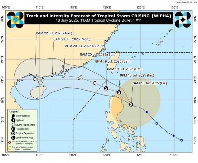
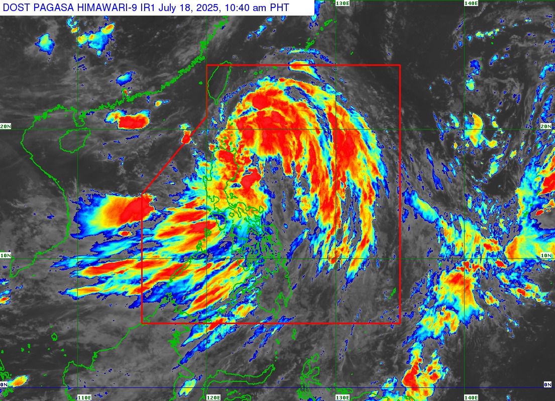
Crising was last located 195 kilometers east of Tuguegarao City, Cagayan with maximum sustained winds of 75 km per hour near the center and gustiness of up to 90 km/h.
The tropical storm was moving west northwestward at 25 km/h.
Crising is expected to make landfall over Cagayan or Babuyan Islands on Friday afternoon or evening, according to PAGASA.
“On the forecast track, a landfall scenario over mainland Cagayan or Babuyan Islands this afternoon or evening is possible. Afterwards, it will move west northwestward traversing over Extreme Northern Luzon until it exits the Philippine Area of Responsibility by tomorrow (19 July) afternoon,” PAGASA said.
Crising may intensify further until it reaches the severe tropical storm category by Saturday morning or afternoon, according to PAGASA. —VAL, GMA Integrated News
