

Gorio maintains strength, direction; Signal No. 1 raised over Batanes
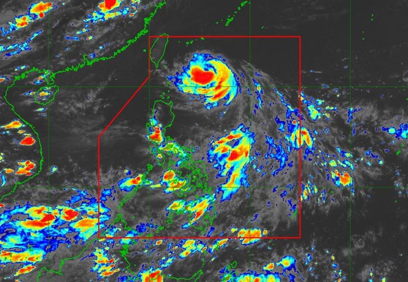
Typhoon Gorio maintains its strength as it moves in the west northwest direction over the past six hours as Signal No. 1 is raised over Batanes, according to the latest Tropical Cyclone Bulletin posted by PAGASA.
The center of Typhoon Gorio was estimated at 440 kilometers east of Itbayat, Batanes packing maximum sustained winds of 120 kilometers per hour near the center, gustiness of up to 150 km/h, central pressure of 975 hPa, and moving west northwestward at the sped of 25 km/h.
There will be strong to typhoon-force winds extend outwards up to 400 km from the center, the weather bureau reported.
Tropical Cyclone Wind Signal (TCWS) No.1 is raised over the following areas:
- Batanes
"Forecast rainfall may be higher in mountainous and elevated areas. Moreover, impacts in some areas may be worsened by significant antecedent rainfall," PAGASA said.
Severe Winds
"The wind signals warn the public of the general wind threat over an area due to the tropical cyclone. Local winds may be slightly stronger/enhanced in coastal and upland/mountainous areas exposed to winds. Winds are less strong in areas sheltered from the prevailing wind direction," the agency added.
The enhanced Southwest Monsoon will bring strong to gale-force gusts over the following areas (especially in coastal and upland areas exposed to winds): Babuyan Islands and the northern portion of mainland Cagayan.
Coastal Inundation
PAGASA also said that no storm surge warning is hoisted but there may be an increased potential for coastal flooding due to high waves near the coast, especially if the track forecast shifts further south.
A Gale Warning is in effect over the Hazards affecting coastal watersseaboard of Extreme Northern Luzon.
Sea travel is risky and all mariners must remain in port or, if underway, seek shelter or safe harbor as soon as possible until winds and waves subside.
Track and Intensity Outlook
"Gorio is forecast to move generally westward for the next 12 hours then turn west northwestward for the entirety of the forecast period," said PAGASA.
The agency added that Gorio may make landfall over the eastern coast of southern Taiwan on Wednesday morning or afternoon and exit the Philippine Area of Responsibility (PAR) by afternoon or evening.
"Gorio is forecast to intensify prior to its landfall to Taiwan before weakening throughout the remainder of the forecast period," PAGASA said. — BAP, GMA Integrated News
