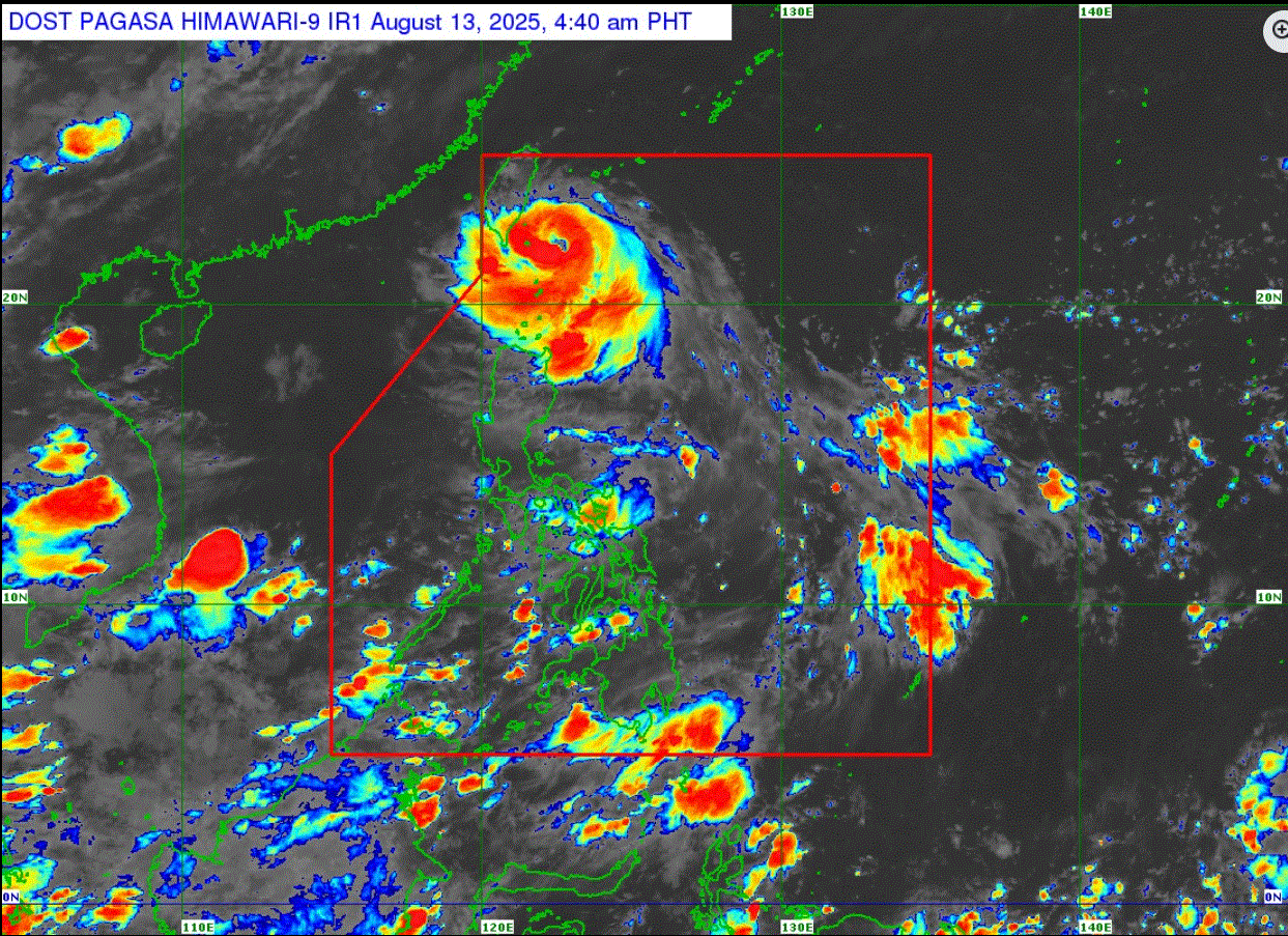
PAGASA: Itbayat, Batanes still under Signal No. 2 as Gorio slightly intensifies

Tropical Cyclone Wind Signal No. 2 remains hoisted over Itbayat in Batanes, while the rest of the island province is under Signal No. 1 as Typhoon Gorio (international name: Podul) slightly intensified approaching the eastern coast of Southern Taiwan.
In its cyclone bulletin, PAGASA said heavy rains with gusty winds are expected over the province.
"While no storm surge warning is hoisted, there may be an increased potential for coastal flooding due to high waves near the coast, especially if the track forecast shifts further south," the state weather bureau added.
The center of the eye of Typhoon Gorio was estimated at 165 kilometers Northeast of Itbayat, Batanes. It has maximum sustained winds of 140 kilometers per hour near the center and gustiness of up to 170 kph.
It is moving west northwestward at 25 kph.
Based on its current track, Gorio may make landfall over the eastern coast of southern Taiwan Wednesday and exit the Philippine Area of Responsibility in the afternoon of the same day.
PAGASA said Gorio is forecast to remain as a typhoon prior to its landfall over Taiwan, before weakening throughout the remainder of the forecast period.
Weather
Due to Gorio, Batanes is seen to experience rains with gusty winds, while the Ilocos Norte, Apayao, and Cagayan will have cloudy skies with scattered rains and thunderstorms.
MIMAROPA, Western Visayas, Negros Island Region, Zamboanga Peninsula, BARMM, SOCCSKSARGEN, Camarines Sur, Catanduanes, Albay, Sorsogon, and Masbate will have cloudy skies with scattered rains and thunderstorms due to the Southwest Monsoon or habagat.
Metro Manila and the rest of the country will have partly cloudy to cloudy skies with isolated rainshowers or thunderstorms as a result of localized thunderstorms.
Sunrise is at 5:42 a.m. and sunset is at 6:20 p.m. —LDF, GMA Integrated News


