

LPA inside PAR has 'high' chance of becoming cyclone
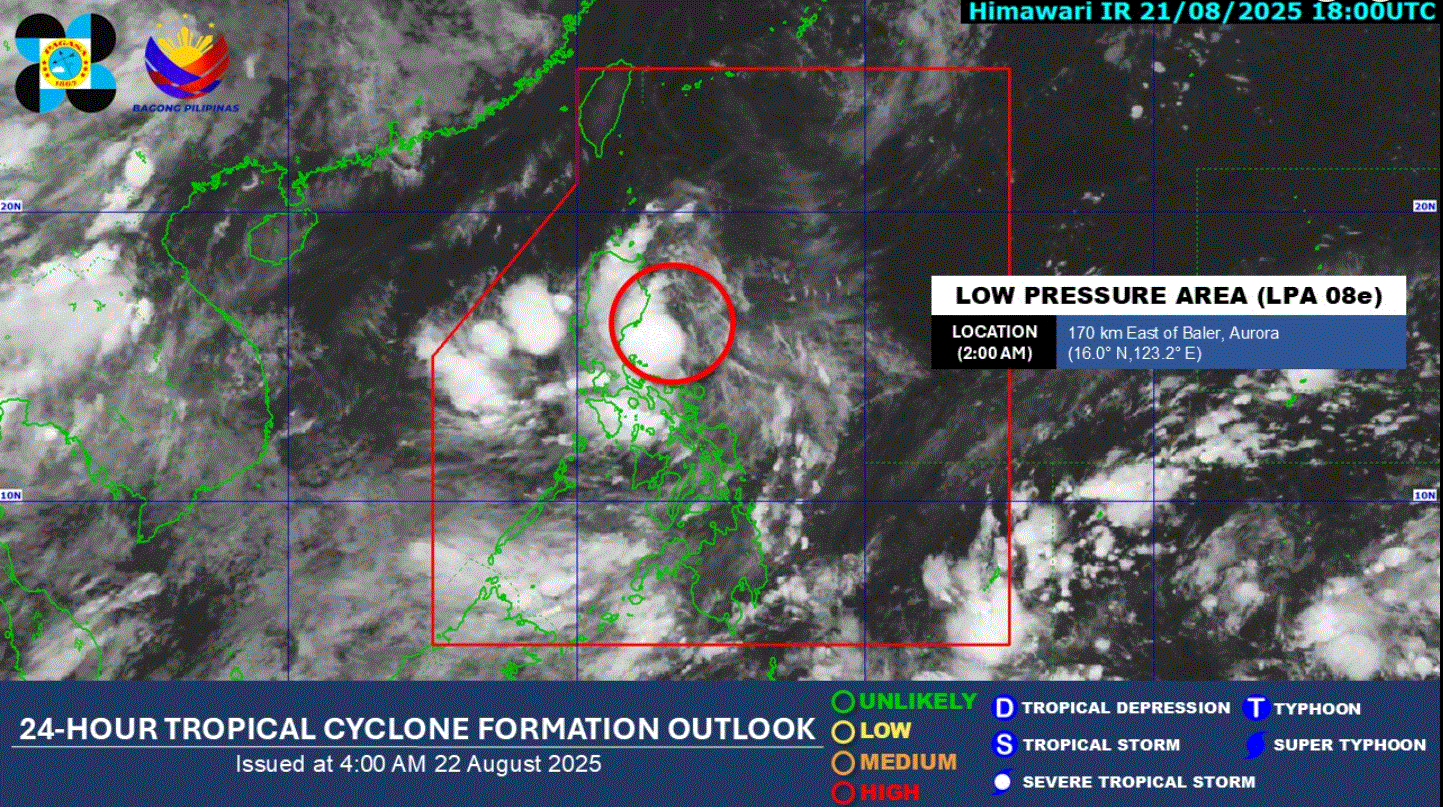
The low pressure area (LPA) being monitored inside the Philippine Area of Responsibility now has a "high potential" of developing into a tropical depression within the next 24 hours, according to PAGASA.
In its 4 a.m. weather bulletin, the weather bureau said the LPA was at 150 kilometers east of Baler, Aurora.
"If the LPA develops into a Tropical Depression, Tropical Cyclone Wind Signal No.1 may be hoisted immediately over some localities in Central and Northern Luzon due to its close proximity to the landmass," PAGASA said.
On Friday, Metro Manila, Ilocos Region, Cordillera Administrative Region, Cagayan Valley, Central Luzon, Laguna, Quezon, Rizal, Camarines Norte, and Camarines Sur are forecast to have cloudy skies with scattered rains and thunderstorms due to the LPA.
The rest of Luzon, Western Visayas, Negros Island Region, Zamboanga Peninsula, BARMM, SOCCSKSARGEN, Lanao del Norte, and Misamis Occidental will have cloudy skies with scattered rains and thunderstorms brought by the Southwest Monsoon.
The rest of Visayas and Mindanao will have partly cloudy to cloudy skies with isolated rainshowers or thunderstorms due to the Southwest Monsoon.
Sunrise is at 5:43 a.m. and sunset is at 6:15 p.m. —LDF, GMA Integrated News
