

LPA has 'low' chance of intensifying but will bring rains
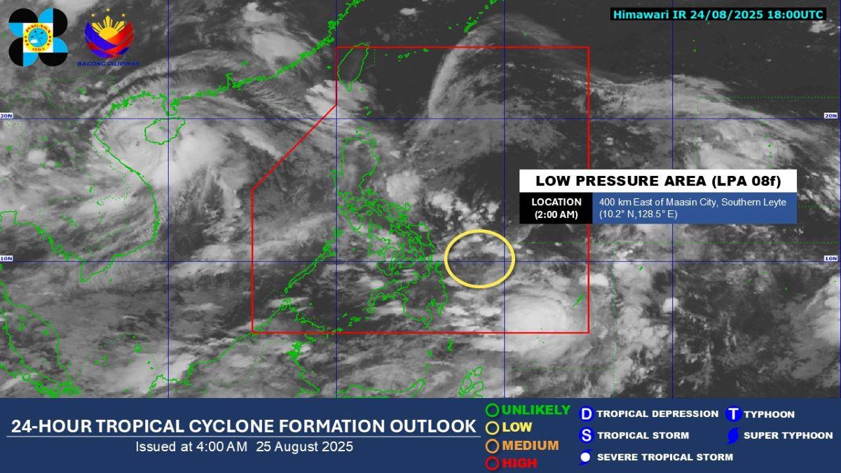
A low pressure area (LPA) inside the Philippine Area of Responsibility has a "low" potential of developing into a tropical depression in the next 24 hours, but will bring rains on Monday, according to PAGASA.
At 3 a.m., the LPA was estimated to be located at 365 km east of Maasin City, Southern Leyte, the weather bureau said in its public weather forecast.
Visayas, Bicol Region, Northern Mindanao, Caraga, and Quezon will have cloudy skies with scattered rains and thunderstorms due to the LPA. Moderate to heavy rains may possibly result in flash floods or landslides.
Albay, Sorsogon, Northern Samar, Eastern Samar, Leyte, and Southern Leyte may expect 50 to 100 mm of rainfall on Monday due to the LPA, PAGASA said in its 5 a.m. heavy rainfall outlook.
Habagat
Meanwhile, the Southwest Monsoon (Habagat) is affecting the western section of Southern Luzon.
Zamboanga Peninsula, Occidental Mindoro, and Palawan may expect cloudy skies with scattered rains and thunderstorms due to the monsoon. Flash floods or landslides may possibly occur due to moderate to at times heavy rains.
Metro Manila and the rest of the country meanwhile will experience partly cloudy to cloudy skies with isolated rain showers or thunderstorms due to localized thunderstorms. During severe thunderstorms, flash floods or landslides may result.
Coastal waters will be moderate in the eastern sections of Luzon and Visayas, and slight to moderate in the rest of the country.
Sunrise was at 5:44 a.m. while sunset will be at 6:13 p.m. —KG, GMA Integrated News
