

Nando intensifies into a typhoon
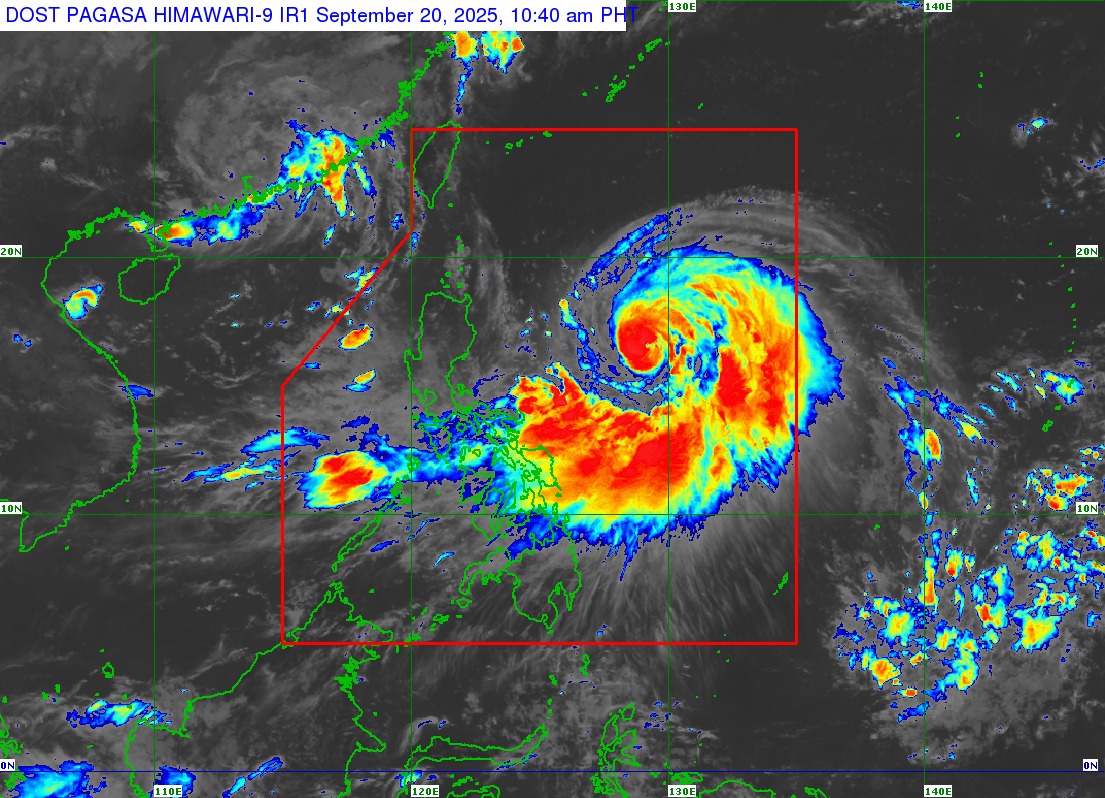
Nando has "rapidly intensified" into a typhoon, but no storm warnings have been raised as of Saturday morning based on PAGASA's 11 a.m. advisory.
Nando, which may reach super typhoon category by Monday, is currently enhancing the Southwest Monsoon.
PAGASA said strong to gale-force gusts are expected over the following areas:
• Today (September 20): Bicol Region, Eastern Visayas, and Caraga
• Tomorrow (September 21): Zambales, Bataan, Tarlac, Pampanga, Bulacan, Metro Manila, CALABARZON, Bicol Region, MIMAROPA, Visayas, Northern Mindanao, Caraga, Davao Occidental, and Davao Oriental.
• Monday (September 22): Central Luzon (areas not under wind signal), Metro Manila, CALABARZON, Bicol Region, MIMAROPA, Visayas, Northern Mindanao, Zamboanga Peninsula, BARMM, SOCCSKSARGEN, Davao Occidental, and Davao Oriental.
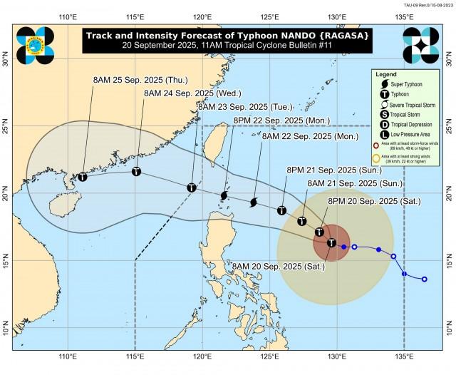
"Nando will continue to intensify while over the Philippine Sea. It may reach super typhoon category by Monday before its close approach to Batanes-Babuyan Islands," PAGASA said.
"Wind Signal No. 1 will be hoisted over Northern Luzon and the eastern portion of Central Luzon this afternoon, and the highest Wind Signal that may be hoisted throughout its passage is Wind Signal No. 5," added PAGASA.
Currently, Nando has maximum sustained winds of 120 km/h near the center and gustiness of up to 150 km/h.
Nando is forecast to move generally northwestward in the next 12 hours before turning west northwestward towards Extreme Northern Luzon.
"Considering these developments, the public and disaster risk reduction and management offices concerned are advised to take all necessary measures to protect life and property. Persons living in areas identified to be highly or very highly susceptible to these hazards are advised to follow evacuation and other instructions from local officials," PAGASA said. --VAL, GMA Integrated News
