

Nando keeps strength; Signal No. 3 in parts of Batanes, Cagayan
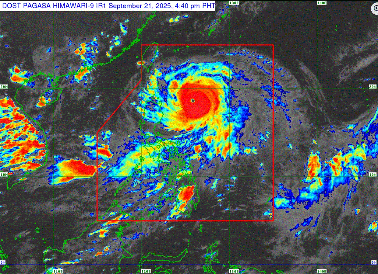
Super typhoon Nando maintained its strength moving west northwest over the Philippine Sea, PAGASA said in its 5 p.m. cyclone bulletin.
The weather bureau warned of heavy rainfall due to the super typhoon and the Southwest Monsoon.
Signal No. 3 is hoisted over the southern portion of Batanes (Mahatao, Uyugan, Basco, Ivana, Sabtang), Babuyan Islands, and the northeastern portion of mainland Cagayan (Santa Ana).
The following Luzon areas are under Signal No. 2:
- the rest of Batanes
- the rest of mainland Cagayan
- the northern and eastern portions of Isabela (San Mariano, Ilagan City, Tumauini, Cabagan, Palanan, Divilacan, Maconacon, San Pablo, Santa Maria, Santo Tomas, Delfin Albano, Quezon, Quirino, Mallig, Roxas, Gamu)
- Apayao
- Abra
- Kalinga
- the eastern portion of Mountain Province (Paracelis),
- Ilocos Norte,
- the northern portion of Ilocos Sur (Cabugao, Sinait, San Juan, Magsingal, Santo Domingo, Bantay, San Ildefonso, San Vicente, Santa Catalina, City of Vigan, Caoayan, Santa, Nagbukel, Narvacan, Santa Maria)
The following areas are under Signal No. 1:
- the rest of Isabela
- Quirino
- Nueva Vizcaya
- the rest of Mountain Province
- Ifugao, Benguet
- the rest of Ilocos Sur
- La Union
- Pangasinan
- the northern and central portions of Zambales ( Santa Cruz, Candelaria, Masinloc, Iba, Palauig, Cabangan, Botolan)
- Nueva Ecija
- Tarlac
- Aurora
- the northern portion of Pampanga ( Mabalacat City, Magalang, Arayat, Candaba, Angeles City, Porac, Mexico, Santa Ana, San Luis, City of San Fernando, Bacolor)
- the northern portion of Bulacan ( Doña Remedios Trinidad, San Ildefonso, San Miguel, San Rafael)
- the northern portion of Quezon ( General Nakar) including Polillo Islands
The center of the eye of super typhoon Nando was located at 450 km East of Aparri, Cagayan. It is moving west northwestward at 15 kilometers per hour with maximum sustained winds of 185 km/h near the center and gustiness of up to 230 km/h.
"On the forecast track, the center of Nando may pass close or may make landfall over Batanes or Babuyan Islands by Monday afternoon or evening. It may exit the Philippine Area of Responsibility by Tuesday early morning," PAGASA said.
It is forecast to further intensify before it approaches extreme Northern Luzon, it added. —LDF, GMA Integrated News
