

Tropical cyclone outside PAR now a typhoon; ITCZ to bring rains over Visayas, Mindanao
The tropical cyclone monitored outside the Philippine Area of Responsibility has developed into a typhoon while the Intertropical Convergence Zone (ITCZ) is expected to bring rains over Visayas and Mindanao, PAGASA said Monday afternoon.
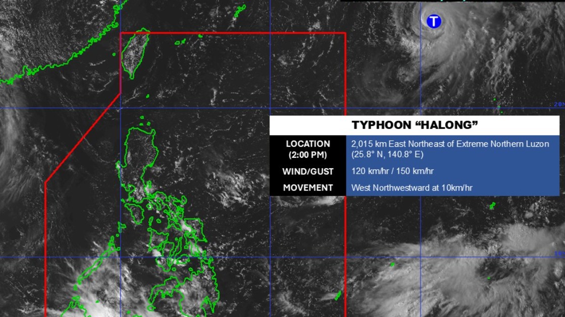
As of 3 p.m., Typhoon Halong was located 2,005 kilometers east northeast of extreme Northern Luzon.
It is carrying a maximum sustained wind of 120 kilometers per hour near the center and gustiness of up to 150 km/h. It was traveling west northwestward at 10 km/h.
Meanwhile, the ITCZ will affect the weather conditions of Western Visayas, Negros Island Region, Central Visayas, Zamboanga Peninsula, Northern Mindanao, and Palawan.
It will also bring partly cloudy to cloudy skies with isolated rainshowers or thunderstorms throughout the rest of Visayas and Mindanao.
Quezon, Aurora, Cagayan Valley, Ilocos Norte, and Apayao will experience cloudy skies and rain due to the Northeasterly Windflow.
Partly cloudy to cloudy skies with isolated rainshowers or thunderstorms will persist in Metro Manila and the rest of Luzon due to localized thunderstorms.
PAGASA warned that these weather conditions may trigger flash floods or landslides.
State meteorologists said the winds will be light to moderate while coastal waters will be slight to moderate throughout the country.
Sunrise in Metro Manila will be 5:46 a.m. on Tuesday. —Mariel Celine Serquiña/RF, GMA Integrated News
