

Northeasterly wind to affect Luzon; LPA outside PAR may become storm
The Northeasterly Windflow is forecast to affect the eastern sections of Northern and Central Luzon, PAGASA said in its weather bulletin.
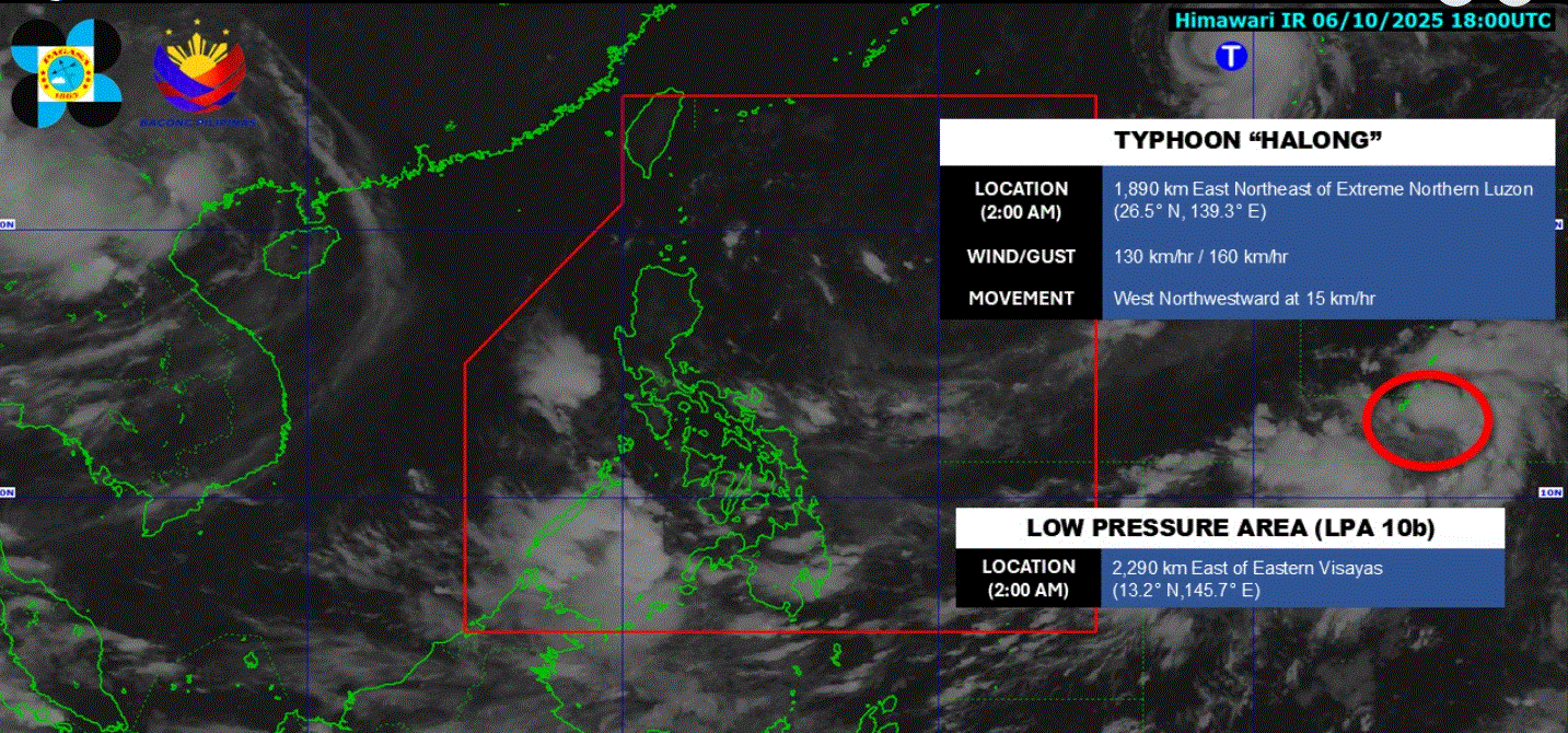
As of 2 a.m., the weather bureau said Typhoon Halong is still being monitored outside the Philippine Area of Responsibility (PAR).
It was spotted 1,875 kilometers east northeast of extreme Northern Luzon and is moving west northwestward at 15 kilometers per hour.
Meanwhile, the Low Pressure Area being monitored outside PAR has a "high" chance of developing into a Tropical Depression within the next 24 hours.
For Tuesday's weather, Bicol Region and Quezon will have cloudy skies with rains due to the Northeasterly Windflow.
The same weather conditions will bring cloudy skies with isolated rainshowers to Cagayan Valley, Ilocos Norte, Apayao, and Aurora.
Mindanao, Visayas, and Palawan will experience cloudy skies with scattered rains and thunderstorms as a result of the Intertropical Convergence Zone.
Metro Manila and the rest of Luzon will have partly cloudy to cloudy skies with isolated rainshowers or thunderstorms due to localized thunderstorms.
Sunrise is at 5:46 a.m. and sunset is at 5:41 p.m. —LDF, GMA Integrated News
