

Tropical Storm Nakri slightly intensifies, nears PAR
Tropical Storm Nakri slightly intensified as it approached the boundary of the Philippine Area of Responsibility (PAR) on Thursday morning, state weather bureau PAGASA said.
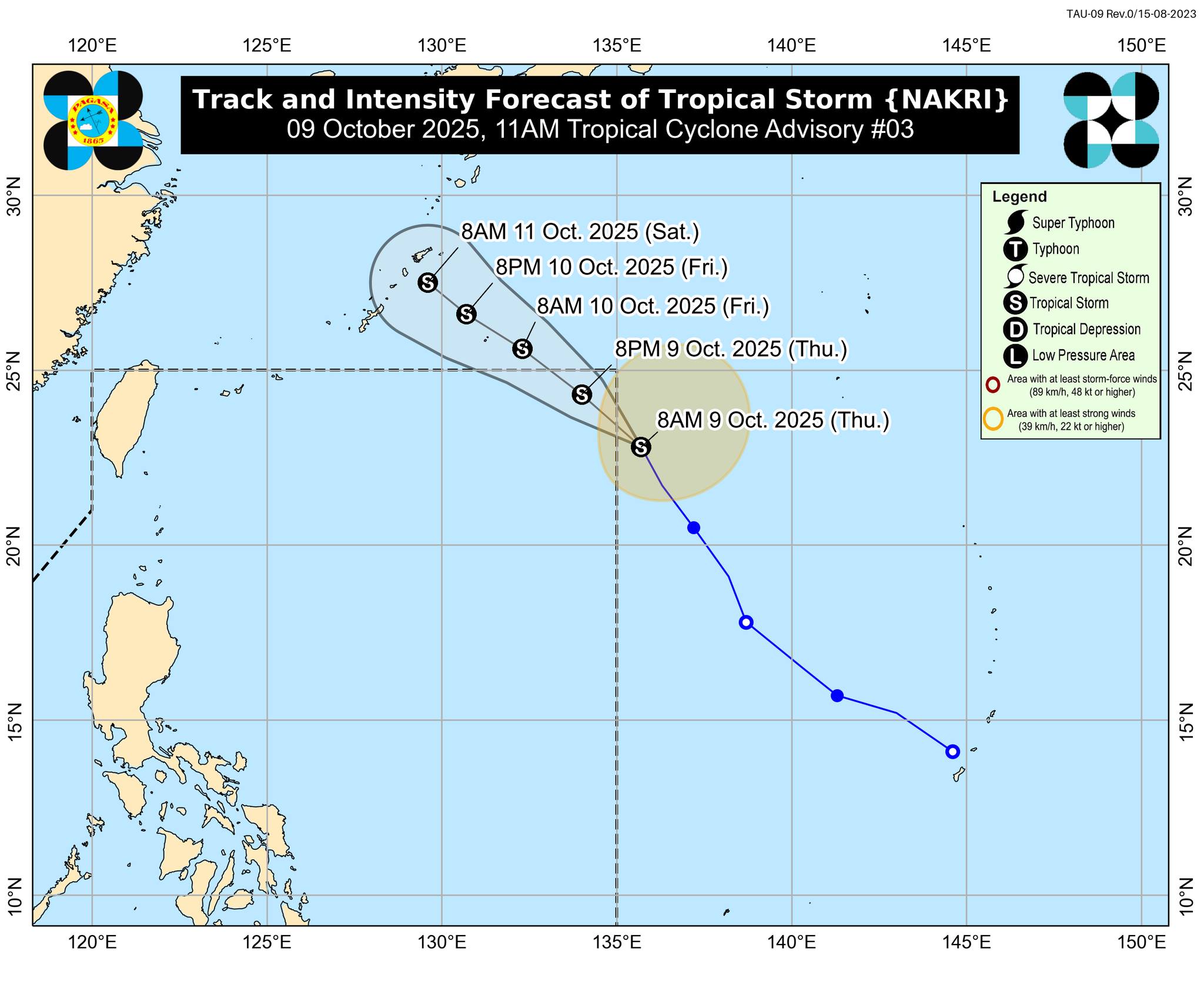
In its 11 a.m. advisory, PAGASA said at 10 a.m., Nakri was spotted 1,415 kilometers east northeast of Extreme Northern Luzon.
The tropical storm was packing maximum sustained winds of 75 km/h near the center and gustiness of up to 90 km/h.
Nakri was moving north northwestward at 25 km/h.
According to PAGASA, Nakri is expected to enter PAR on Thursday afternoon or evening and will be given the local name “Quedan.”
“Inside PAR, Quedan will continue moving northwestward and may exit PAR tonight or tomorrow (October 10) early morning,” PAGASA said.
“This weather disturbance is forecast to continue intensifying while approaching [the] Ryukyu Islands,” it added.
No Tropical Cyclone Wind Signal will be raised for this tropical cyclone, which is less likely to directly affect the weather and sea conditions in the country throughout the forecast period, PAGASA said.
However, PAGASA said the southwesterlies and the northeasterly windflow would bring strong gale-force gusts to some areas.
This wind condition is expected on Thursday in Batanes, the Babuyan Islands, Ilocos Norte, Palawan, the Negros Island Region, Central Visayas, Leyte, Southern Leyte, Caraga, Northern Mindanao, the Zamboanga Peninsula, BARMM, SOCCSKSARGEN, Davao Occidental, Davao del Sur, and Davao Oriental. —Joviland Rita/VBL, GMA Integrated News
