

Quedan exits PAR
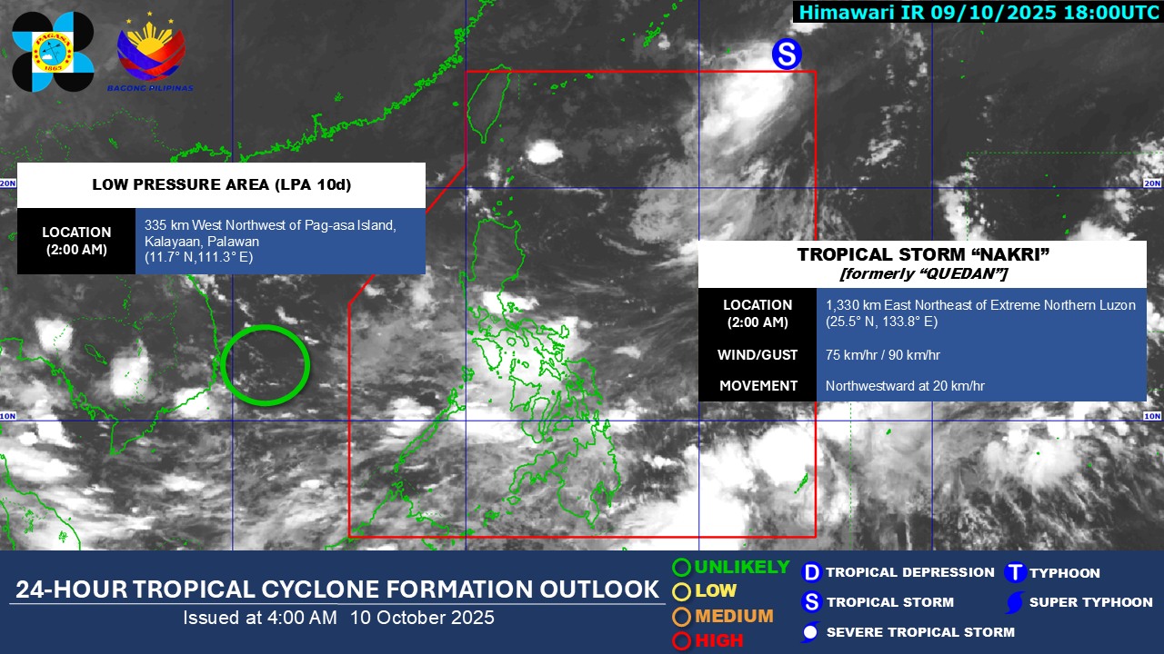
Tropical Storm Nakri (formerly Quedan) has exited the Philippine Area of Responsibility (PAR), according to PAGASA, early Friday morning.
Quedan exited PAR as of 2 a.m. according to the state weather bureau. At 4 a.m., the center of storm was estimated based on all available data at 1,355 km East Northeast of Extreme Northern Luzon (26.3°N, 133.7°E).
It has maximum sustained winds of 75 km/h near the center, gustiness of up to 90 km/h, and central pressure of 998 hPa.
Quedan was moving North northwestward at 20 km/h
In its 4 a.m. weather bulletin, PAGASA said the trough of a Low Pressure Area will affect Southern Luzon and the Southwesterly Windlow will bring cloudy skies with scattered rains and thunderstorms in the Visayas and Mindanao.
The same conditions will also affect Metro Manila, Central Luzon, CALABARZON, Bicol Region and the rest of MIMAROPA.
Meanwhile, LPA 10d being monitored outside the Philippine Area of Responsibility (PAR) is unlikely to develop into a Tropical Depression within the next 24 hours.
Sunrise is will be at 5:47 a.m. while sunset is at 5:39 p.m. today. —RF, GMA Integrated News
