

PAGASA: LPA has 'low' chance of becoming tropical depression
The low pressure area (LPA) being monitored inside the Philippine Area of Responsibility has a “low” potential of becoming a tropical depression in the next 24 hours, the state weather bureau said on Sunday night.
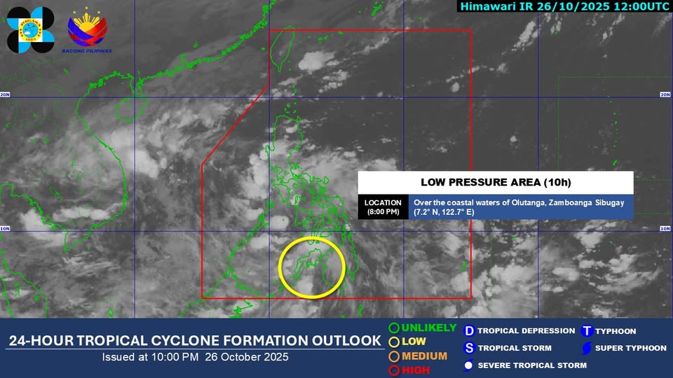
In its 10 p.m. advisory on Facebook, the Philippine Atmospheric, Geophysical and Astronomical Services Administration said the LPA was last seen over the coastal waters of Olutanga, Zamboanga Sibugay as of 8 p.m. Sunday.
The state weather bureau advised the public to monitor its weather bulletins for the latest updates on the LPA.
In its previous 2 p.m. advisory, PAGASA said the LPA was unlikely to develop into a tropical depression in the next 24 hours.
In its 4 p.m. public weather forecast, PAGASA said the LPA was embedded along the Intertropical Convergence Zone that is currently affecting Palawan, Visayas, and Mindanao.
Visayas, Mindanao, Bicol region and Palawan will experience cloudy skies with scattered rains and thunderstorms as a result of the LPA, with the possibility of flash floods or landslides due to moderate to at times heavy rains.
Batanes and Babuyan Islands will have cloudy skies with scattered rains and thunderstorms as an effect of the shearline.
Meanwhile, Aurora and Quezon will experience cloudy skies with scattered rains and thunderstorms due to the easterlies.
Metro Manila and the rest of Luzon will also experience the effect of the easterlies and will have partly cloudy to cloudy skies with isolated rainshowers or thunderstorms.
The northern and western sections of Northern Luzon will experience moderate to strong winds and moderate to rough coastal water conditions.
The eastern sections of Northern Luzon and Central Luzon, the rest of Luzon, and other parts of the country will have light to moderate winds and slight to moderate coastal water conditions.
Sunrise on Monday is at 5:50 a.m. — JMA, GMA Integrated News
