

Tropical Storm Kalmaegi enters PAR, is now called Tino
A tropical storm named Kalmaegi entered the Philippine Area of Responsibility (PAR) on Sunday morning and was called Tino, PAGASA said in its weather forecast.
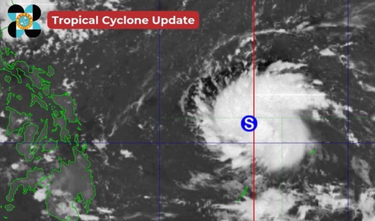
As of 3 a.m., the storm's center was estimated to be located at 1,230 km east of Eastern Visayas, which was then still outside PAR.
The storm has maximum sustained winds of 85 km/h near the center and with gustiness of up to 105 km/h.
It is moving west northwestward at 15 km/h.

The storm is not yet expected to directly affect the weather condition on Sunday, DOST-PAGASA weather specialist Obet Badrina said during the public weather forecast.
However, its trough or extension will bring cloudy skies with scattered rains and thunderstorms over Northern Samar, Eastern Samar, and Dinagat Islands today. Moderate to at times heavy rains may possibly result in flash floods or landslides.
Tino may make landfall over Caraga or Eastern Visayas on Tuesday morning, Badrina said.
"Medyo magiging mabilis ang bagyo at maapektuhan ang malaking bahagi ng Visayas, Northern Mindanao, Southern Lizon, Bicol," Badrina said.
(The storm may move fast and will affect a large part of Visayas, Northern Mindanao, Southern Luzon, and Bicol.)
It may thereafter emerge over the West Philippine Sea, he added.
Within 24 hours, however, Tino may start to affect the weather conditions.
Tropical Cyclone Wind Signal (TCWS) No. 1 will be hoisted over Eastern Visayas and Caraga today, PAGASA said.
The highest TCWS that may be raised is No. 4 as Tino is expected to reach typhoon category.
Heavy rains may be expected on Monday over Eastern Samar and Dinagat Islands (100 to 200 mm) and over Catanduanes, Albay, Sorsogon, Northern Samar, Samar, Leyte, Biliran, Southern Leyte, and Surigao del Norte (50 to 100 mm).
A gale warning may be raised over Eastern Visayas and Caraga as early as Sunday night or early Monday morning.
On Tuesday, the rainfall outlook is 100 to 200 mm of rainfall over Masbate, Northern Samar, Eastern Samar, Samar, Leyte, Southern Leyte, Biliran, Cebu, Negros Occidental, Iloilo, Capiz, Aklan, Guimaras, and Dinagat Islands.
Rainfall amounting to 50 to 100 mm meanwhile may be expected on Tuesday over Romblon, Marinduque, Oriental Mindoro, Catanduanes, Albay, Sorsogon, Antique, Negros Oriental, Bohol, Siquijor, Surigao del Norte, Agusan del Norte, Camiguin, Misamis Oriental, Lanao del Norte, Misamis Occidental, and Zamboanga del Norte.
Shear line, Amihan
Meanwhile, the shear line is affecting the eastern sections of Northern and Central Luzon on Sunday, while the Northeast Monsoon (Amihan) is affecting the rest of Northern Luzon, PAGASA said.
Ilocos Region and Batanes will have cloudy skies with rains due to the monsoon. Flash floods or landslides may result due to moderate to at times heavy rains.
Cordillera Administrative Region, Aurora, Quezon, and the rest of Cagayan Valley may expect cloudy skies with scattered rains and thunderstorms due to the shear line.
Meanwhile, Metro Manila and the rest of the country will have generally fair weather in the morning, with partly cloudy to cloudy skies with isolated rain showers or thunderstorms in the afternoon or evening. During severe thunderstorms, flash floods or landslides may occur.
Coastal waters
Northern Luzon and the eastern sections of Central and Southern Luzon will have moderate to rough coastal waters, while the eastern sections of Visayas and Mindanao may expect theirs to be moderate.
The rest of the country meanwhile will have slight to moderate coastal waters.
Sunrise was at 5:52 a.m. while sunset will be at 5:27 p.m. —KG, GMA Integrated News
