

Signal No. 1 up in 4 areas as Tino makes landfall Monday in E. Samar
Signal No. 1 was hoisted over four areas in Eastern Samar and Mindanao as Tropical Storm Tino is expected to make landfall in the province on Monday, PAGASA said late Sunday morning.
Based on the state weather bureau’s 11 a.m. weather bulletin, the three areas in Mindanao are Dinagat Islands and Siargao and Bucas Grande Islands.
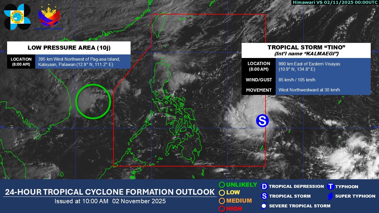
Tino was located 955 km east of Eastern Visayas, and is carrying maximum sustained winds of 85 km/h near the center and gusts of up to 105 km/h, and is moving westward at 30 km/h.
PAGASA said minimal to minor impacts from strong winds are possible within any of the areas under Wind Signal No. 1.
Meanwhile, Signal No. 4 is the highest wind signal that will likely be hoisted throughout Tino’s passage.
Tino entered the Philippine Area of Responsibility (PAR) earlier today.
State meteorologists said that today, the surge of the Northeast Monsoon (Amihan) coinciding with the passage of Tino will bring strong to gale-force gusts over Batanes, Babuyan Islands, Ilocos Norte, the northern and eastern portion of Cagayan, the eastern portion of Isabela, Aurora, Quezon, Lubang Islands, Marinduque, Calaguas Islands, and Caluya Islands, which are not under any wind signal.
“It must be emphasized that heavy rainfall, severe winds, and storm surge may still be experienced in localities outside the landfall point and the forecast confidence cone,” PAGASA said.
Tino is expected to move generally westward over the next three days and make its initial landfall over Eastern Samar or Dinagat Islands on Monday late evening or on Tuesday early morning.
“Afterwards, Tino will traverse Visayas and northern Palawan before emerging over the West Philippine Sea on Wednesday morning or afternoon,” PAGASA said.
It added that the storm is forecast to intensify continuously and may reach typhoon category within the next 24 hours.
“It will likely make its initial landfall at or near peak intensity (currently forecasted around 150-155 km/h maximum winds). Rapid intensification within the next 48 hours is likely,” PAGASA said.
“The possibility of reaching super typhoon category is not ruled out based on alternate scenarios and climatological data,” it added.
Despite its passage over the country that will trigger a slight weakening, Tino is expected to remain as a typhoon throughout its passage over the country, state meteorologists said. — Mariel Celine Serquiña/RF, GMA Integrated News
