

Signal No.1 up in 9 areas as Tino intensifies into severe tropical storm
Tropical Storm Tino intensified into a severe tropical tropical storm on Sunday afternoon, the state weather bureau PAGASA said.
According to the 5 p.m. weather bulletin, Tropical Cyclone Wind Signal No. 1 is raised over the following areas:
Visayas
- Eastern Samar
- Northern Samar
- Samar
- Biliran
- Leyte
- Southern Leyte,
- Camotes Islands
Mindanao
- Dinagat Islands
- Surigao del Norte
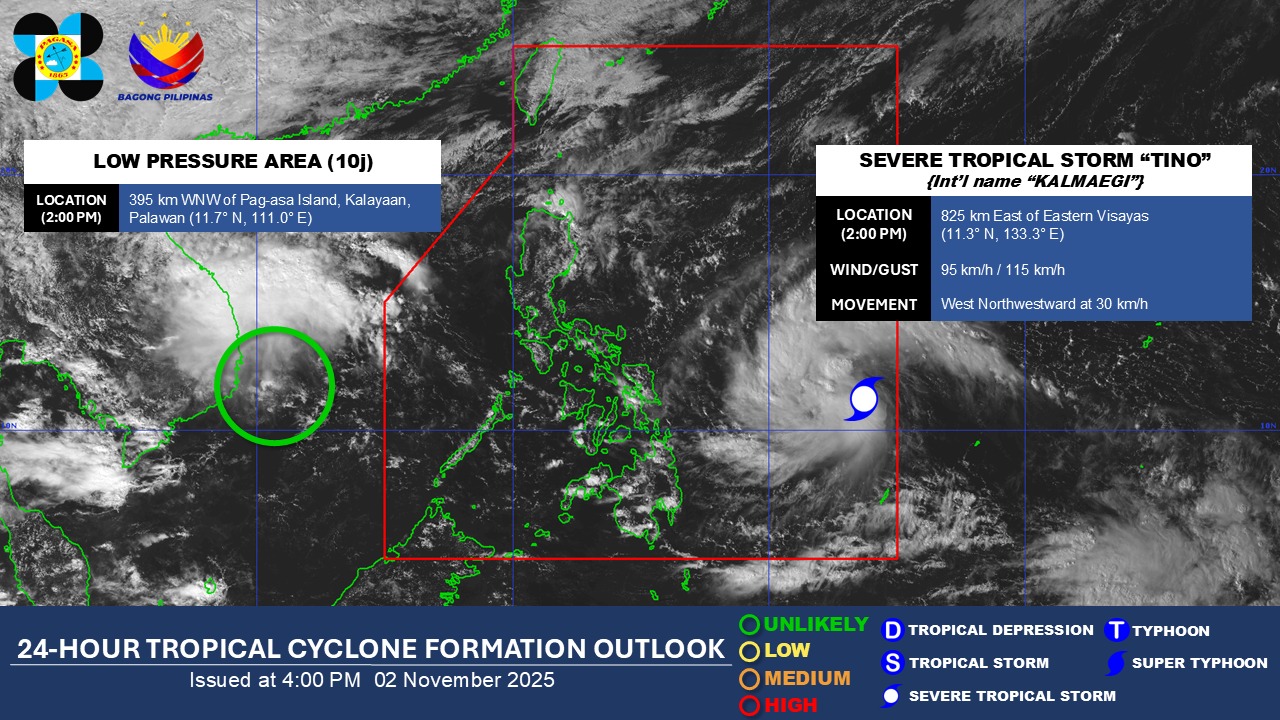
The center of Tino was 805 kilometers east of Eastern Visayas. It has maximum sustained winds of 95 kilometers per hour near the center and gustiness of up to 115 kilometers per hour.
It is moving westward at 30 kilometers per hour, PAGASA added.
PAGASA said that Tino will move generally westward over the next three days and will make its initial landfall over Eastern Samar or Dinagat Island on either Monday evening, November 3 or on early Tuesday, November 4.
Further, PAGASA said that Tino is expected to continuously intensify and may reach the typhoon category within the next 24 hours. The possibility of reaching the super typhoon category is also not ruled out.
On the other hand, another low pressure area being monitored outside the Philippine Area of Responsibility - which is located 395 west northwest of Pag-asa Island, Kalayaan, Palawan - is unlikely to develop into a tropical depression, according to PAGASA earlier. —Vince Angelo Ferreras/RF, GMA Integrated News
