

Kalayaan Islands under Signal No. 1 as Tino exits PAR
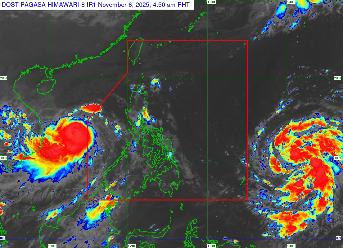
Typhoon Tino has exited the Philippine Area of Responsibility (PAR), but the Kalayaan Islands remain under Signal No. 1, according to the state weather bureau PAGASA's report early Thursday morning.
PAGASA said Tino left the PAR at 12:30 a.m. At 4 a.m., it was located 265 km north northwest of Pag-asa Island, Kalayaan, Palawan, carrying maximum sustained winds of 155 km/h near the center and gustiness of up to 190 km/h.
Tino, which left at least 85 people dead and affected 1.2 million individuals in seven regions, was moving west northwestward at 35 km/h.
"On the forecast track, Tino will move generally west northwestward towards Central Vietnam," PAGASA said in its 5 a.m. bulletin.
"Due to marginally favorable conditions, Tino will slightly weaken prior to its landfall over Central Vietnam within the next 24 hours. Upon landfall, it will then rapidly weaken further due to interaction with the terrain."
Due to the typhoon, the Kalayaan Islands will experience rains with gusty winds, while its trough will bring cloudy skies with scattered rains and thunderstorms over the Zamboanga Peninsula, Aurora, Quezon, the rest of Palawan, Basilan, and Tawi-Tawi.
Batanes will have cloudy skies with rains because of the Northeast Monsoon (Amihan), while Cagayan will see cloudy skies with scattered rains and isolated thunderstorms due to the shear line.
The rest of the country will experience localized thunderstorms.
Winds will be moderate to strong and coastal waters will be moderate to rough in the western sections of Central and Southern Luzon, as well as Northern Luzon.
Light to moderate winds and slight to moderate coastal waters are expected for the rest of the country. —VBL, GMA Integrated News
