

PAGASA: Uwan exits PAR, but expect stormy weather in parts of Northern Luzon
Typhoon Uwan has exited the Philippine area of responsibility but parts of Northern Luzon will continue to experience stormy weather due to Uwan’s effects, the state weather bureau said on Tuesday.
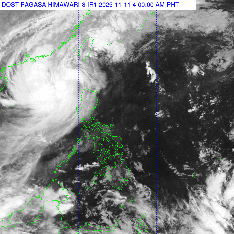
In its 4 a.m. daily weather forecast, PAGASA said the center of the typhoon was located at 290 kilometers west northwest of Laoag City, Ilocos Norte or 355 west of Calayan, Cagayan, outside the PAR.
It is packing maximum sustained winds of 120 km/h near the center with gustiness of up to 150 km/h, moving northward at 15 km/h.
Uwan exited the PAR at around 1:30 a.m. Tuesday and is expected to recurve and reenter the PAR on Wednesday evening near Taiwan.
Earlier in its 2 a..m. advisory, the state weather bureau lifted the storm surge warning in relation to Uwan, as its “areas of maximum winds are now offshore and continue to move farther away from the Philippine landmass.”
However, PAGASA advised the public of stormy weather in the Ilocos Region, Cordillera Administrative Region, and Cagayan on Tuesday as a result of the typhoon.
Similarly, Metro Manila, Central Luzon, Calabarzon, and the rest of Cagayan Valley will experience rains with gusty winds due to Uwan’s effects.
Meanwhile, Western Visayas and the rest of Luzon will have cloudy skies with scattered rains and thunderstorms as a result of the trough of Uwan.
The rest of Visayas and Mindanao will experience partly cloudy to cloudy skies with isolated rainshowers or thunderstorms on Tuesday due to localized thunderstorms in the area.
Southern Luzon and Visayas will have moderate to strong winds and moderate to rough coastal water conditions.
The western section of Mindanao and the rest of Mindanao will experience light to moderate winds and slight to moderate coastal water conditions.
Sunrise on Tuesday, November 11 is at 5:55 a.m. while sunset is at 5:25 p.m. — JMA, GMA Integrated News
