

TS Koto's trough, other weather systems to bring rains over PH — PAGASA
State weather bureau PAGASA continues to monitor the effects of a tropical storm outside the Philippine Area of Responsibility (PAR) as several weather systems are expected to continue bringing rains over parts of the country.
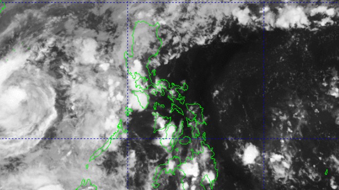
According to PAGASA's daily weather forecast on Saturday afternoon, the trough of Tropical Storm Koto (formerly Verbena) is predicted to bring cloudy skies with scattered rains and thunderstorms over the Kalayaan Islands.
Koto was last seen at 360 kms northwest of Pagasa Island in Kalayaan, Palawan.
It carries maximum sustained winds of 85 kph and gusts of up to 105 kph.
Apayao and Cagayan will have cloudy skies with scattered rains and isolated thunderstorms due to a shear line, while Ilocos Region, Batanes, and the rest of Cordillera Administrative Region will have cloudy skies with light rains due to the Amihan or Northeast Monsoon.
Localized thunderstorms will cause partly cloudy to cloudy skies with isolated rain showers or thunderstorms over Visayas, Mindanao, and the rest of Palawan.
The rest of the country will have partly cloudy to cloudy skies with isolated rain showers or thunderstorms caused by the easterlies.
Possible flash floods or landslides may occur in some areas as a result of these weather conditions.
Meanwhile, moderate to strong winds with moderate to rough seas will be felt over Northern Luzon and Palawan.
The rest of the country will experience light to moderate winds with slight to moderate coastal waters.
Sunrise in Metro Manila will be at 6:05 a.m. on Sunday. — Jiselle Anne Casucian/ GMA Integrated News
