

Nando slightly accelerates over PH Sea, wind signal expected Saturday morning
Tropical Cyclone Wind Signal (TCWS) warning is expected to be hoisted over Northern Luzon on Saturday as Tropical Storm Nando slightly accelerated moving over the Philippines Sea Friday morning, state weather bureau PAGASA said.
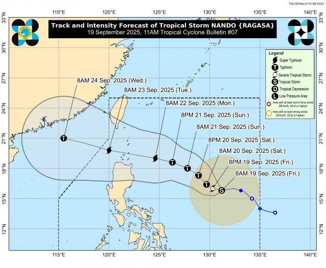
“Wind Signal No. 1 will be hoisted over Northern Luzon tomorrow (20 September) morning, and the highest Wind Signal that may be hoisted throughout its passage is Wind Signal No. 5,” PAGASA said in its 11 a.m. bulletin.
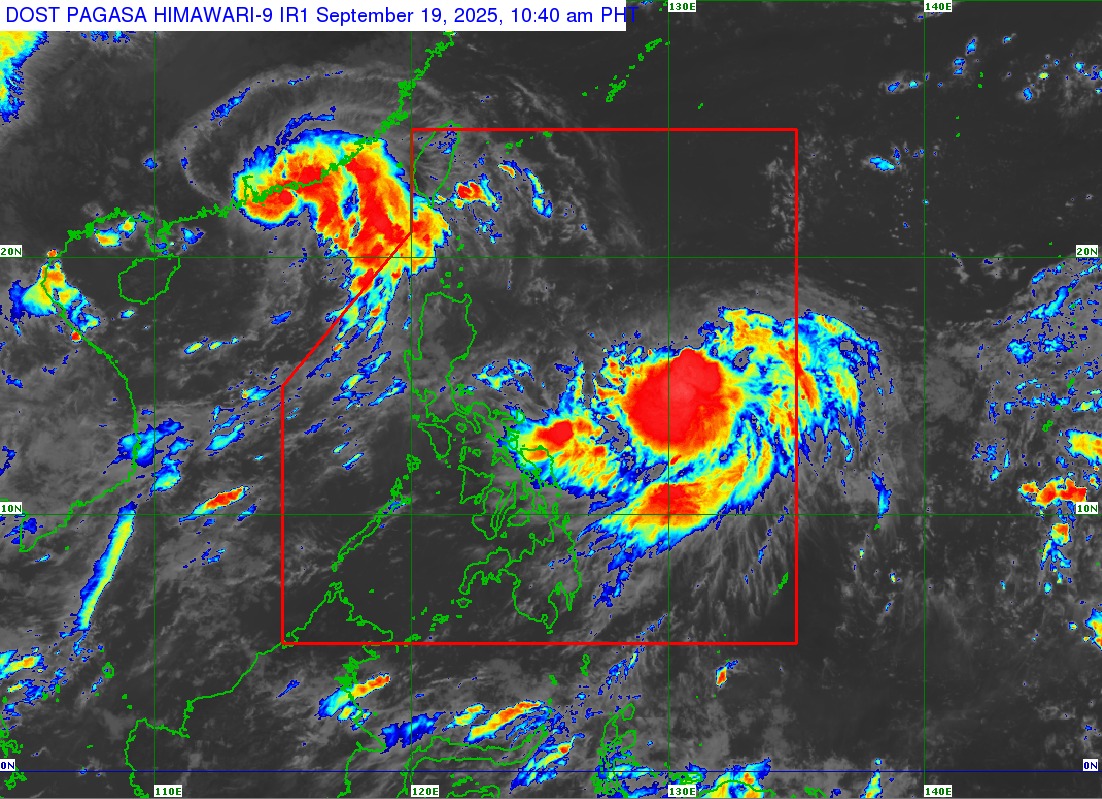
Nando was last spotted 1,005 kilometers east of Central Luzon, packing maximum sustained winds of 75 km per hour near the center and gustiness of up to 90 kph.
The tropical storm was moving westward at 20 kph.
Nando and the Southwest Monsoon or Habagat are expected to start causing heavy rains on Sunday.
According to PAGASA, Nando’s trough and Habagat on Friday will bring strong to gale-force gusts over the coastal and upland areas exposed to winds in Ilocos Region, Zambales, Bataan, Bicol, and Eastern Visayas.
Moderate to rough seas are expected over most of the coastal waters of Luzon starting Sunday. Waves may reach up to 14.0 meters as Nando approaches Extreme Northern Luzon.
“Storm surge warning may be raised over the coastal waters of Northern Luzon tomorrow (20 September),” PAGASA said.
Nando may reach the super typhoon category by Monday, according to PAGASA.
On the forecast track, PAGASA said Nando may pass close or may make landfall over Babuyan Islands between Monday afternoon and Tuesday early morning.
“Nando will continue to intensify while over the Philippine Sea. It may reach typhoon category tomorrow and super typhoon by Monday before its close approach to Babuyan Islands,” it added.
The tropical cyclone may exit the Philippine area of responsibility by Tuesday noon or afternoon. —VAL, GMA Integrated News
