

Paolo now a severe tropical storm; Signal No. 3 in Ilocos, CAR provines
Tropical cyclone Paolo is again a severe tropical storm from being a stronger typhoon, the state weather bureau PAGASA said.
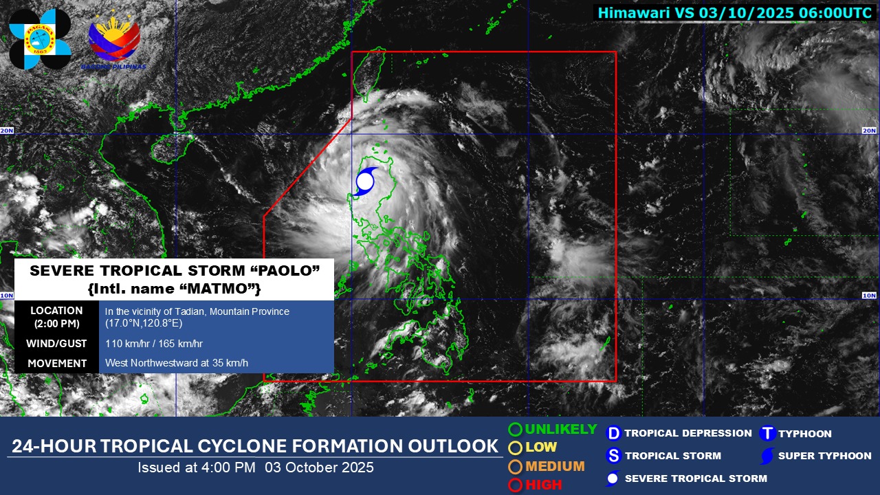
According to the 5 p.m. weather bulletin, the center of Paolo was monitored over the coastal waters of Santa Cruz, Ilocos Sur. It has maximum sustained winds of 110 kilometers per hour near the center and gustiness of up to 165 kilometers per hour.
PAGASA also said that it is moving west northwestward at 35 kilometers per hour.
As Paolo lost some strength, Signal No. 4 was lifted in several areas. The following areas are under Signal No. 3:
- Ilocos Sur
- La Union
- the southwestern portion of Abra (Boliney, Sallapadan, Bucloc, Tayum, Bangued, Langiden, Pidigan, San Quintin, Pilar, Luba, Manabo, Villaviciosa, San Isidro, Peñarrubia, Bucay, Tubo)
- the western portion of Kalinga (Tinglayan, Pasil)
- the western portion of Mountain Province (Besao, Tadian, Sagada, Bauko, Sadanga, Bontoc, Sabangan)
- the western portion of Ifugao (Hungduan, Tinoc)
- Benguet
Meanwhile, the following areas are under Signal No. 2:
- The southern portion of Ilocos Norte (Nueva Era, Badoc, Pinili, City of Batac, Paoay, Currimao, Banna, Laoag City, San Nicolas, Sarrat, Dingras, Solsona, Marcos, Bacarra, Piddig, Pasuquin, Vintar, Carasi)
- Pangasinan
- the rest of Abra
- the rest of Kalinga
- the rest of Mountain Province
- the rest of Ifugao
- the western portion of Isabela (Cordon, Ramon, San Mateo, City of Santiago, Quezon, Mallig, Roxas, Aurora, San Manuel, Cabatuan)
- the northwestern portion of Quirino (Cabarroguis, Saguday, Diffun)
- the northern and central portions of Nueva Vizcaya (Dupax del Norte, Aritao, Santa Fe, Bayombong, Bagabag, Villaverde, Kasibu, Bambang, Diadi, Quezon, Solano, Dupax del Sur, Ambaguio, Kayapa)
- the northernmost portion of Nueva Ecija (Carranglan)
Further, Signal No. 1 is hoisted in the areas below:
- The rest of Ilocos Norte
- Apayao
- Batanes
- mainland Cagayan including Babuyan Islands
- the rest of Isabela
- the rest of Quirino
- the rest of Nueva Vizcaya
- Aurora
- the rest of Nueva Ecija
- Tarlac
- Zambales
- Pampanga
- Bulacan
- the northern portion of Quezon (General Nakar, Infanta) including Polillo Islands
However, PAGASA said that Paolo is forecast to re-intensify into a typhoon within the next 12 hours. The severe tropical storm may exit the Philippine Area of Responsibility (PAR) on Saturday morning, October 4.
According to the 24-hour weather forecast issued at 4 p.m., Paolo may bring stormy weather over Ilocos Region, Abra, Kalinga, Mountain Province, Ifugao, and Benguet.
The severe tropical storm is also forecast to bring rains with gusty winds over Cagayan Valley, Apayao, Zambales, Tarlac, Nueva Ecija, Pampanga, Bulacan, Aurora, and Quezon. –NB, GMA Integrated News
Meanwhile, Paolo’s trough may bring cloudy skies with scattered rains and thunderstorms over Metro Manila, Mimaropa, the rest of Calabarzon, and Bataan. –Vince Angelo Ferreras/NB, GMA Integrated News