

PCG, Chinese embassy clash over Spanish-era map with West PH Sea features
The Philippine Coast Guard (PCG) and the Chinese Embassy in Manila exchanged arguments over the relevance of an 1875 Spanish-era map to Manila’s claims in the West Philippine Sea (WPS.)
“Disregarding treaties and international law, misinterpreting maps, and denying historical facts will not help manage differences through dialogue,” Chinese embassy spokesperson Guo Wei said on Thursday.
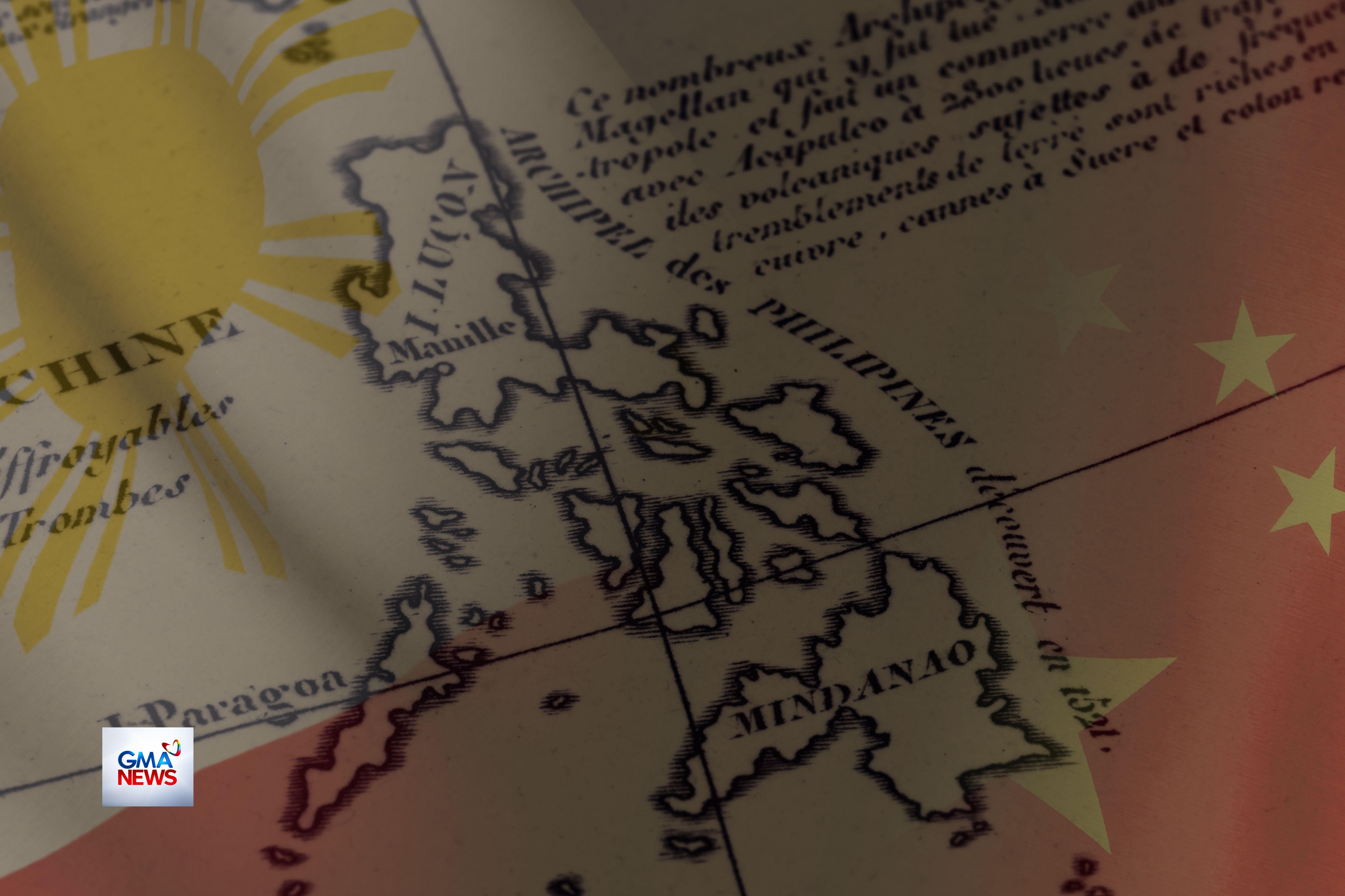
On March 29, PCG spokesperson for WPS Rear Admiral Jay Tarriela cited the 1875 Carta General del Archipiélago Filipino as a key document supporting the Philippines’ position over disputed features.
The 1875 Carta General del Archipiélago Filipino is a historical map of the Philippine archipelago originally prepared during the Spanish colonial period. It was later republished by the United States for administrative and military use.
According to Tarriela, the map is among the "most detailed" official Spanish charts of the Philippine archipelago.
This depicts features such as “Los Bajos de Paragua,” associated with the Spratly Islands, and “Panacot,” also known as Bajo de Masinloc or Scarborough Shoal.
EXPLAINER: What is Scarborough Shoal and why is it important?
“This map strengthens the historical basis for the Philippines’ position over these features, as it was later adopted and reissued by the United States War Department after the Spanish-American War,” Tarriela earlier said.
However, Wei disputed these assertions and called Tarriela’s claims “wrong.”
Guo argued that the 1875 map was “merely a geographical map” with no indication of sovereignty or political boundaries.
The embassy also cited the 1928 Island of Palmas arbitration, pointing out that the Spanish era map had been rejected due to the absence of boundary markings.
Guo further challenged the identification of “Panacot” with Bajo de Masinloc, claiming historical maps instead refer to a different location.
On March 30, Tarriela pushed back against the embassy’s claims.
He said the map helped inform the Treaty of Paris and the Treaty of Washington, which transferred the Philippines from Spain to the United States.
Tarriela also rejected China’s interpretation of the Island of Palmas case, saying it was being “misused” and was unrelated to the disputed features in the WPS.
He maintained that historical maps and records consistently place Panacot at the location of Bajo de Masinloc.
For Tarriela, 2016 South China Sea Arbitration had already invalidated China’s sweeping “historic rights” claims beyond its lawful maritime zones.
“The 2016 Arbitral Award under UNCLOS already settled the legal status: China’s “historic rights” claims beyond its lawful maritime zones have no legal basis. The Philippines is not “distorting history” — we are defending it with treaties, official maps, and international law,” Tarriela said.
“We remain committed to dialogue and diplomacy based on UNCLOS and the 2016 Award. But diplomacy requires acknowledging facts, not rewriting them to justify continued harassment of our fishermen and Coast Guard in our own exclusive economic zone,” he added. —VAL, GMA News
