

 GMA Brandtalk
 Tracking
 Archives

Queenie keeps strength, moves northwestward
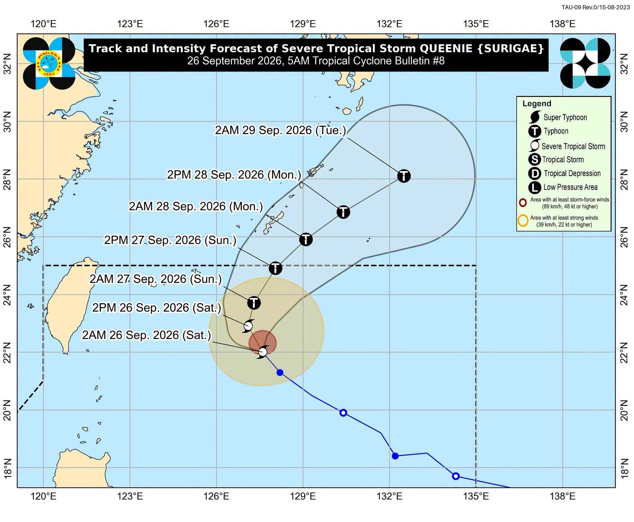
Severe Tropical Storm Queenie maintained its strength over the Philippine Sea, state weather bureau PAGASA said in its 5 a.m. Saturday bulletin.
As of 4 a.m., Queenie was located 600 kilometers east of Itbayat, Batanes, packing maximum sustained winds of 95 kilometers per hour near the center and gustiness of up to 115 km/h.
The storm was moving northwestward at 15 km/h. PAGASA said Queenie is expected to continue slowing down while moving north-northwestward over the next 12 hours before turning north-northeastward by Sunday morning.
Queenie is set to intensify into a typhoon by Saturday evening or Sunday and further strengthen as it moves over the waters south of Okinawa. It is forecast to begin weakening by Monday.
Queenie is expected to exit the Philippine Area of Responsibility (PAR) between Sunday afternoon and evening.
For the next 24 hours, the Intertropical Convergence Zone (ITCZ) will bring cloudy skies with scattered rains and thunderstorms over the Negros Island Region, Central Visayas, Zamboanga Peninsula, Northern Mindanao, Caraga, Palawan, and Davao Oriental.
Partly cloudy to cloudy skies with isolated rain showers or thunderstorms are expected over the rest of the Visayas and Mindanao.
Metro Manila and the rest of Luzon will experience localized thunderstorms.
Winds will be light to moderate across the country, while coastal waters will be slight to moderate. — VBL, GMA News

