

 GMA Brandtalk
 Tracking
 Archives


Severe Tropical Storm Cempaka may enter PAR on Sunday evening or early Monday
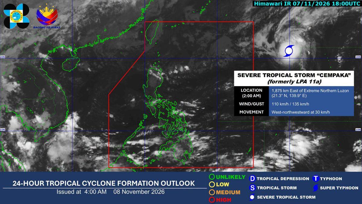
Severe Tropical Storm Cempaka may enter the Philippine Area of Responsibility (PAR) either on Sunday evening or early Monday, November 9, state weather bureau PAGASA said.
However, it will not directly affect the country, PAGASA weather specialist Obet Badrina said Sunday.
"Itong si Severe Tropical Storm Cempaka ay maaring pumasok ng PAR, posibleng mamayang gabi o bukas ng madaling araw. Hindi naman ito direktang makakaapekto sa bansa," Badrina said during the public weather forecast.
(Severe Tropical Storm Cempaka may enter PAR either later this evening or tomorrow early morning. But it won't directly affect the country.)
As of 3 a.m., Cempaka was monitored 1,865 kilometers east of extreme Northern Luzon.
It has maximum sustained winds of 110 kilometers per hour near the center, and gustiness of up to 135 kilometers per hour.
Once it enters PAR, it will be given the local name "Samuel."
The storm is also moving west northwestward at 30 kilometers per hour.
On the other hand, the Northeast Monsoon (Habagat) and the easterlies are expected to bring rains over the country on Sunday.
The Habagat may bring cloudy skies with light rains over Cagayan, Isabela, Apayao, Kalinga, and Mountain Province.
Likewise, the monsoon may also bring partly cloudy to cloudy skies with isolated light rains over Ilocos Region, Central Luzon, the rest of Cordillera Administrative Region, and the rest of Cagayan Valley.
Moreover, the easterlies is expected to bring cloudy skies with scattered rains and thunderstorms over Bicol Region, Eastern Visayas, Quezon, Surigao del Norte, Surigao del Sur, Dinagat Islands, and Davao Oriental.
The easterlies is also forecast to cause partly cloudy to cloudy skies with isolated rainshowers or thunderstorms over Metro Manila and the rest of the country. —KG, GMA News

