

Ineng slightly intensifies, continues move towards southern China
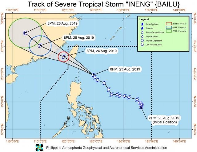
Severe Tropical Storm Ineng has slightly intensified and continues to move towards southern Taiwan-Batanes Area on Friday evening, PAGASA reported in the latest Severe Weather Bulletin.
As of 10 p.m, the center of Severe Tropical Storm Ineng was estimated at 260 kilometers east southeast of Basco, Batanes packing maximum sustained winds of up to 100 kilometers per hour near the center and gustiness of up to 125 kph moving Northwest at 20 kph.
Tropical Cyclone Wind Signal (TCWS) No. 2 is hoisted over Batanes and Babutyan Islands.
TCWS No. 1 is raised over Cagayan, Isabela, Apayao, Kalinga, Northern Abra and Ilocos Norte.
Ineng is expected to cross the Bashi Channel and will be closest to Batanes on Saturday morning.
On Saturday, moderate to heavy rains may prevail over Ilocos Region, Cordillera Administrative Region, Batanes, Babuyan Islands, Zambales, and Bataan.
Light to moderate with intermittent heavy rains may be experienced over Cagayan, Metro Manila, Cavite, Laguna, Batangas, Rizal, Mindoro Provinces and northern portions of Palawan (including Calamian and Cuyo Islands).
Residents in the affected, especially those living in areas prone to flash floods and landslides, are advised to take precautionary measures, coordinate with local disaster risk reduction and management offices, and continue monitoring for updates.
Areas under TCWS are warned against strong winds associated with Ineng.
Meanwhile, sea travel is risky over the seaboards of areas under TCWS and the eastern seaboards of Central Luzon, Southern Luzon, and Visayas due to potentially rough sea conditions.
Severe Tropical Storm Ineng is expected to exit the Philippine Area of Responsibility (PAR) tomorrow evening. — BAP, GMA News
