

Signal No. 2 over Zambales as Jolina continues northwest direction
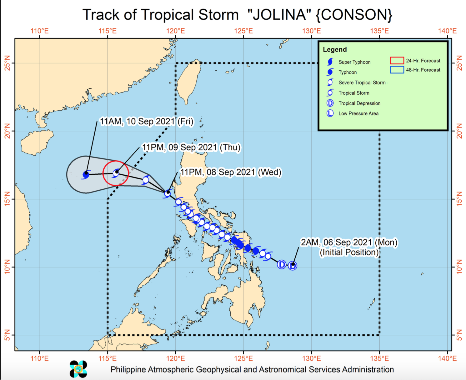
Tropical Storm Jolina continues to move northwestward away from Zambales on Thursday morning, according to the 2 a.m. Severe Weather Bulletin posted by PAGASA.
As of 1 a.m., the center of Tropical Storm Jolina was estimated at 75 kilometers west northwest of Iba, Zambales with maximum sustained winds of 85 kilometers per hour near the center, gustiness of up to 115 kph, and central pressure of 998 hPa.
Jolina is moving northwestward at a speed of 30 kph.
Tropical Cyclone Wind Signal (TCWS) No. 2 is hoisted over the following areas:
LUZON
- the central portion of Zambales (San Antonio, Cabangan, San Felipe, Palauig, San Narciso, Iba, Botolan, Candelaria, Masinloc)
TCWS No. 1 is raised over the following areas:
LUZON
- the western portion of Pangasinan (Anda, Malasiqui, Bolinao, Infanta, Aguilar, Calasiao, Basista, Urbiztondo, Sual, Mangaldan, Labrador, Alcala, Dasol, San Carlos City, Santa Barbara, Bayambang, Binmaley, Mapandan, Bugallon, Burgos, Mabini, Bautista, Agno, Dagupan City, City of Alaminos, Bani, Lingayen, Santo Tomas, Mangatarem, Villasis)
- the western portion of Pampanga (Porac, Magalang, Lubao, Bacolor, Floridablanca, Guagua, Angeles City, City of San Fernando, Santa Rita, Mabalacat City, Sasmuan, Mexico)
- Bataan
- Tarlac
- the rest of Zambales
The weather bureau said Tropical Cyclone Wind Signal No. 1 in other areas is lifted.
HAZARDS AFFECTING LAND AREAS
In the next 24 hours, moderate to heavy rains will be experienced over Zambales, Bataan, Pampanga, and Pangasinan and floodings may occur especially in susceptible areas.
Winds reaching gale force in strength will still continue for couple more hours within any of the areas where TCWS No. 2 is in effect that ay cause light to moderate damage to structures and vegetation.
Several coastal areas of Zambales and Bataan may still experience coastal inundation resulting from hazardous surf conditions.
HAZARDS AFFECTING COASTAL WATERS
In the next 24 hours, Tropical Storm Jolina will bring rough to very rough seas over the seaboards of areas under TCWS No. 2 so sea travel is risky for all types of seacrafts.
In areas under TCWS No. 1, there may be moderate to rough seas over the seaboards and so mariners of small seacrafts are advised to take precautionary measures when venturing out to sea.
Jolina will move generally northwestward today over the West Philippine Sea and exit the Philippine Area of Responsibility (PAR) on Thursday evening. -- BAP, GMA News
