

Kiko about to pass close to Babuyan Island, Signal No. 4 remain over two areas
Typhoon Kiko is now about to make landfall or pass very close to Babuyan island early Saturday morning, according to the Tropical Cyclone Bulletin posted by PAGASA.
Tropical Cyclone Wind Signal (TCWS) No. 4 is hoisted over the following areas:
- Batanes
- the northeastern portion of Babuyan Islands
TCWS No. 3 is raised over the following areas:
- the extreme northeastern portion of Cagayan (Santa Ana, Gonzaga)
- the rest of Babuyan Islands
Areas under TCWS No. 2 are:
- the northern portion of mainland Cagayan (Aparri, Camalaniugan, Lal-Lo, Gattaran, Baggao, Buguey, Santa Teresita, Amulung, Alcala, Lasam, Ballesteros, Abulug, Allacapan, Claveria, Santa Praxedes, Sanchez-Mira, Pamplona, Santo Niño)
- the northern portion of Apayao (Calanasan, Luna, Pudtol, Flora, Santa Marcela)
TCWS No. 1 is over the following areas:
- the rest of mainland Cagayan
- the northern portion of Ilocos Norte (Pagudpud, Adams, Dumalneg, Bangui, Vintar, Carasi, Nueva Era, Piddig, Solsona, Burgos, Pasuquin, Bacarra, Laoag City, San Nicolas, Sarrat, Dingras)
- the rest of Apayao
- the northern portion of Kalinga (Balbalan, Pinukpuk, City of Tabuk, Rizal)
- the eastern portion of Mountain Province (Paracelis)
- the northeastern portion of Abra (Tineg, Lacub, Malibcong)
- the northern portion of Isabela (Palanan, City of Cauayan, Cabatuan, Aurora, Luna, Benito Soliven, Naguilian, Reina Mercedes, Ilagan City, Quezon, Burgos, Tumauini, San Manuel, Santo Tomas, Roxas, Santa Maria, Mallig, Quirino, Cabagan, Delfin Albano, Gamu, San Pablo, Maconacon, Divilacan, San Mariano)
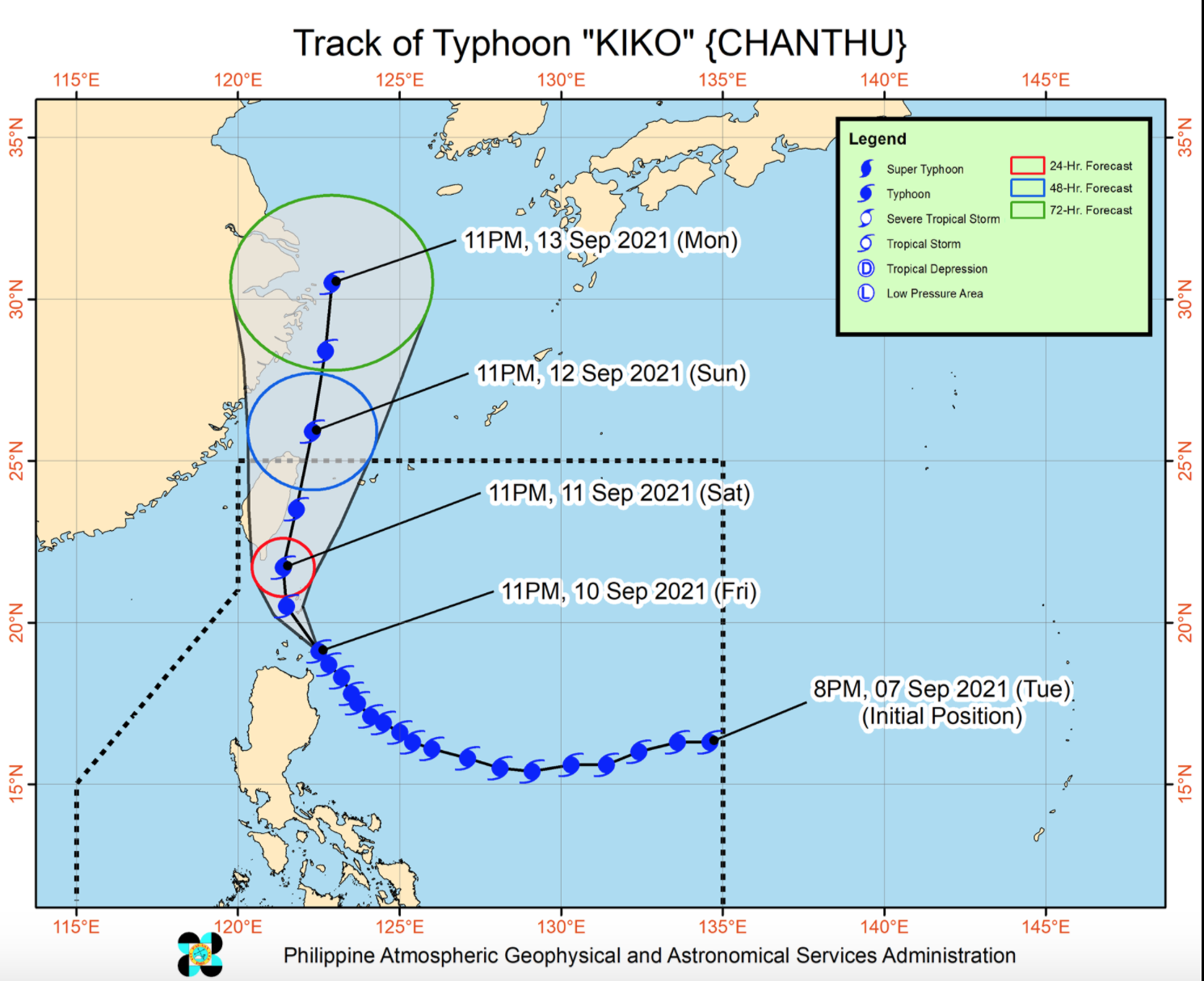
As of 1 a.m., the center of the eye of Typhoon Kiko is located over the coastal waters of Babuyan Island, Calayan, Cagayan with maximum sustained winds of 215 kilometers per hour near the center, gustiness of up to 265 km/h, and central pressure of 920 hPa.
Kiko is currently moving in the northwest direction moving at a speed of 20 km/h.
In the next 24 hours, Kiko will bring heavy to intense with at times torrential rains over Babuyan Islands and Batanes and moderate to heavy with at times intense rains are also likely over Ilocos Region, Cordillera Administrative Region, and mainland Cagayan.
Kiko will continue to enhance the Southwest Monsoon, bringing monsoon rains over Metro Manila, the western sections of Central Luzon and Southern Luzon, and Western Visayas in the next 24 hours.
Winds may reach typhoon-force strength between 171 and 220 km/h within any of the areas where TCWS No. 4 is hoisted during the passage of the typhoon that may cause generally heavy to very heavy damage to structures and vegetation.
Wind strength of up to 170 km/h within any of the areas under TCWS No. 3 and gale- to storm-force strength within any of the areas where TCWS No. 2 is in effect.
In the next 24 hours, rough to phenomenal seas will be experienced over the seaboards of areas where TCWS is in effect. Sea travel is risky for all types of sea vessels. Mariners are advised to remain in port or take shelter in port until winds and waves subside.
On Saturday, Kiko will move northwestward or north northwestward over the coastal waters of northeastern mainland Cagayan, Babuyan Islands, and Batanes. -- BAP, GMA News
