

 GMA Brandtalk
 Tracking
 Archives

Kiko heads towards Batanes, Signal No. 4 remains over two areas
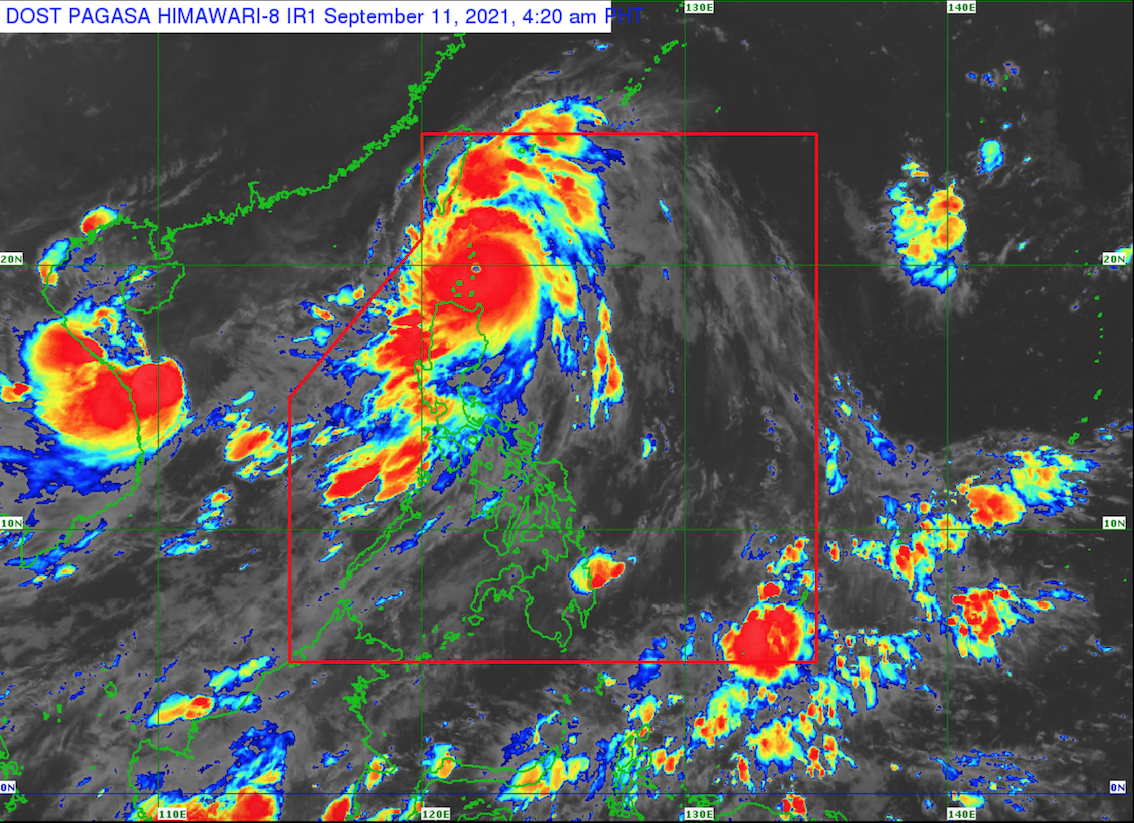
Typhoon Kiko has passed to the east of Babuyan Island and is now heading towards Batanes, according to the Tropical Cyclone Bulletin posted by PAGASA early Saturday morning.
Tropical Cyclone Wind Signals (TCWS) No. 4 is hoisted over the following areas:
- Batanes
- the northeastern portion of Babuyan Islands (Babuyan Is.)
TCWS No. 3 is raised over the following areas:
- the northwestern and southeastern portions of Babuyan Islands (Panuitan Is., Calayan Is., Camiguin Is., Pamuktan Is., Didicas Is.)
TCWS No. 2 is raised over the following areas:
- the northern portion of mainland Cagayan (Santa Ana, Gonzaga, Santa Teresita, Buguey, Sanchez-Mira, Pamplona, Ballesteros, Abulug, Camalaniugan, Aparri, Claveria, Santa Praxedes)
TCWS No. 1 is raised over the following areas:
- the rest of mainland Cagayan
- the northern portion of Ilocos Norte (Adams, Dumalneg, Bangui, Vintar, Carasi, Nueva Era, Piddig, Solsona, Burgos, Pasuquin, Bacarra, Laoag City, San Nicolas, Sarrat, Dingras, Pagudpud)
- Apayao
- the northern portion of Kalinga (Balbalan, Pinukpuk, City of Tabuk, Rizal)
- the northeastern portion of Abra (Tineg, Lacub, Malibcong)
- the northern portion of Isabela (Divilacan, Ilagan City, Quirino, Quezon, Mallig, Tumauini, Maconacon, San Pablo, Cabagan, Delfin Albano, Santo Tomas, Santa Maria)
The weather bureau said the TCWS previously hoisted in other areas are lifted.
As of 4 a.m., the center of the eye of Typhoon Kiko was located at 75 kilometers south of Basco, Batanes with maximum sustained winds of 215 kilometers per hour near the center, gustiness of up to 265 km/h, central pressure of 920 hPa and moving north northwestward at 15 km/h.
Weather conditions
Stormy weather will be experienced in Batanes and the northeastern portion of Cagayan including Babuyan Islands brought about by Typhoon Kiko with possible flash floods or landslides due to heavy to intense rains. Up to very heavy damage to structures and vegetation possible due to gale-force to typhoon-force winds.
Kiko will also bring rains and gusty winds over Ilocos Norte, Apayao, the rest of Cagayan, Abra, Kalinga, and the northern portion of Isabela with possible flash floods or landslides due to moderate to heavy rains. Very light to light damage to structures and vegetation possible due to moderate to strong winds.
Metro Manila, the rest of Ilocos Region, the rest of Cordillera Administrative Region, and the western sections of Central and Southern Luzon will have monsoon rains in the next 24 hours. The typhoon is enhancing the Southwest Monsoon.
The typhoon and the Southwest Monsoon will also bring cloudy skies with scattered rain showers and thunderstorms over the rest of Luzon and Western Visayas that may cause flash floods or landslides due to moderate with at times heavy rains.
For the rest of Visayas and Mindanao, the Southwest Monsoon and local thunderstorms will bring partly cloudy to cloudy skies with isolated rain showers and thunderstorms. Flash floods or landslides may occur due to moderate with at times heavy rains.
Kiko is forecast to maintain its strength while traversing the Babuyan-Batanes area in the next 12 hours but is forecast to begin weakening later today or Sunday as the typhoon undergoes another eyewall replacement cycle. —BAP/KG, GMA News

