

Lannie continues movement over west of PAR
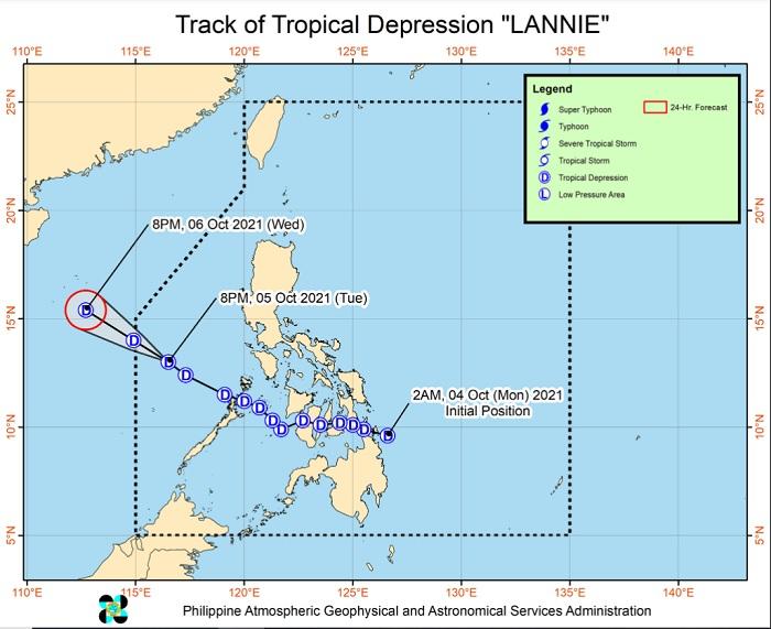
Tropical depression Lannie continued to move over the western limit of the Philippine Area of Responsibility (PAR) as it dampens Palawan, the weather bureau PAGASA said Tuesday.
In its 11 p.m. weather bulletin, PAGASA found that the tropical depression was last spotted at 545 kilometers west of San Jose, Occidental Mindoro or 550 km west of Calapan City, Oriental Mindoro at 10 p.m.
Lannie is packing maximum sustained winds of 45 kilometers per hour near the center, gustiness of up to 55 kph. Its movement slowed down by five kph from 30 kph to 25 kph.
From Tuesday evening to Wednesday morning, Lannie will likely bring moderate to heavy rains over Palawan.
"Under these conditions, isolated to scattered flooding (including flash floods) and rain-induced landslides are still likely especially in areas that are highly or very highly susceptible to these hazards as identified in hazard maps," PAGASA said.
Lannie is expected to exit the PAR on Wednesday morning, state meteorologists also said.
Sea conditions
Due to sea conditions caused by tropical depression and the enhanced easterlies and southwesterlies, PAGASA issued a Gale Warning over the seaboards of Northern Luzon and the western seaboards of Southern Luzon.
Moreover, it cautioned small boats on sea voyages as it will be risky due to moderate to rough seas over the remaining western seaboard of Luzon and the eastern seaboard of the country. -- BAP, GMA News
