

LPA inside PAR ‘unlikely’ to turn into storm — PAGASA
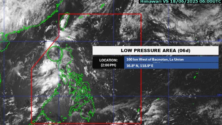
The low pressure area (LPA) observed inside the Philippine Area of Responsibility (PAR) is “unlikely” to develop into a tropical depression within the next 24 hours, PAGASA said Wednesday afternoon.
At 3 p.m., the LPA was located 170 kilometers west of Bacnotan, La Union.
It will affect the weather conditions of Metro Manila, Bataan, Zambales, Oriental Mindoro, Occidental Mindoro, Batangas, and Cavite, according to the state weather bureau’s 4 p.m. daily weather forecast.
Meanwhile, the Intertropical Convergence Zone will bring cloudy skies with scattered rains and thunderstorms over Surigao del Sur, Davao Oriental, Davao Occidental, Sarangani, and Sultan Kudarat.
These moderate to at times heavy rains may cause flash floods and landslides.
Partly cloudy to cloudy skies with isolated rain showers or thunderstorms will persist throughout the rest of the country due to the easterlies.
These severe thunderstorms may trigger flash floods and landslides.
State meteorologists also said winds will be light to moderate, while coastal waters will be slight to moderate throughout the country.
Sunrise in Metro Manila will be at 5:28 a.m. on Thursday. —Mariel Celine Serquiña/RF, GMA Integrated News
