

LPA inside PAR has ‘medium’ chance of becoming storm — PAGASA
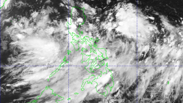
The low pressure area (LPA) inside the Philippine Area of Responsibility has a “medium” chance of developing into a tropical depression within the next 24 hours, PAGASA said Monday afternoon.
At 3 p.m., the LPA was located 920 kilometers east of Central Luzon.
Meanwhile, LPA’s trough will affect the weather conditions of Bicol Region, Aurora, and Quezon, according to the state weather bureau’s 4 p.m. daily weather forecast.
The Southwest Monsoon (Habagat) will bring cloudy skies with scattered rains and thunderstorms over Metro Manila, Visayas, Mindanao, MIMAROPA, and the rest of Central Luzon and CALABARZON.
These moderate to at times heavy rains may trigger flash floods and landslides.
Partly cloudy to cloudy skies with isolated rain showers or thunderstorms will persist over the rest of Luzon due to localized thunderstorms.
These severe thunderstorms may cause flash floods and landslides.
State meteorologists also said winds will be light to moderate, while coastal waters will be slight to moderate throughout the country.
Sunrise in Metro Manila will be at 5:31 a.m. on Tuesday. —Mariel Celine Serquiña/RF, GMA Integrated News
