

Gorio on track to intensify into typhoon, unlikely to directly affect PH
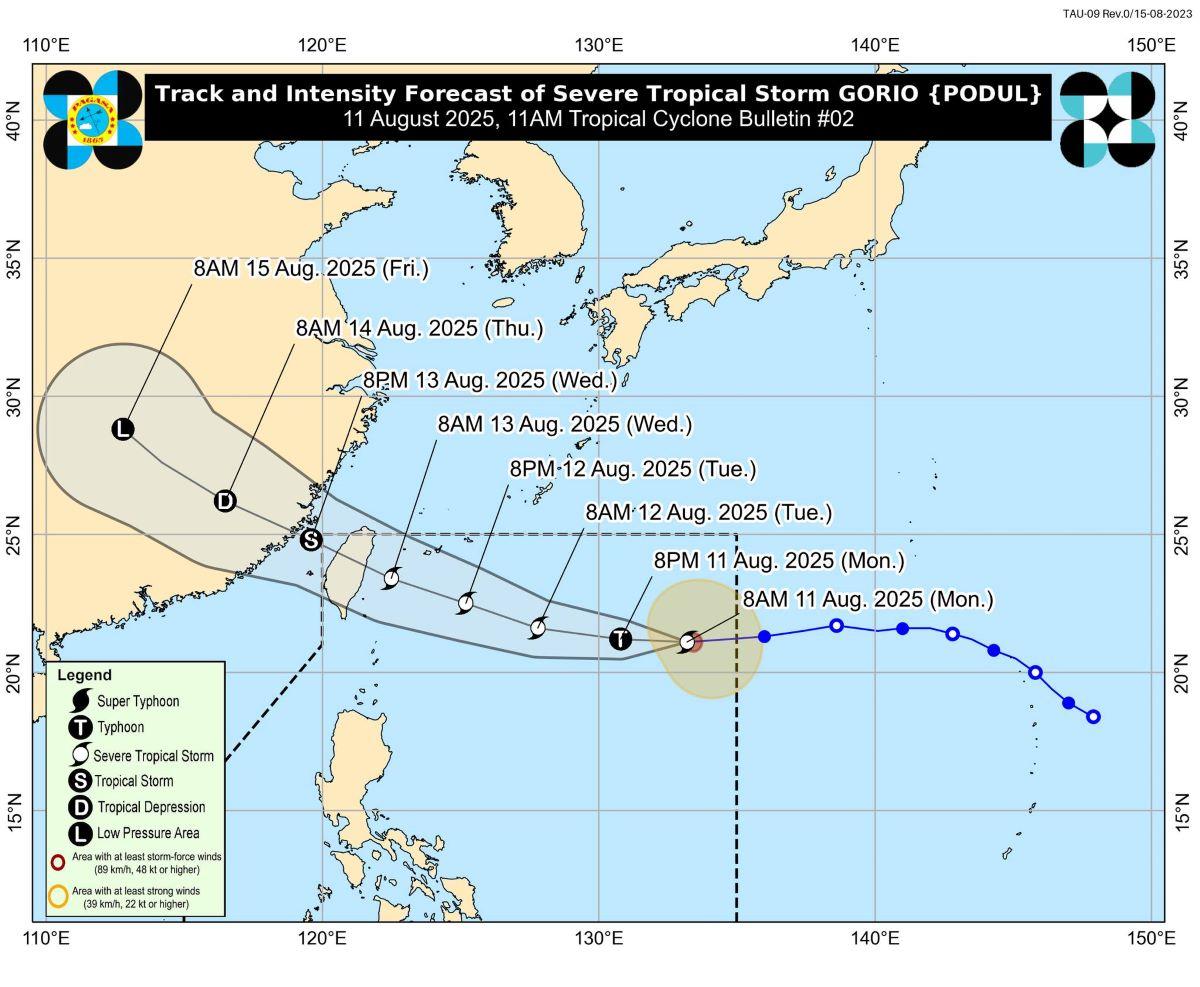
Severe Tropical Storm Gorio, internationally known as Podul, is expected to intensify into a typhoon within the next 12 hours, PAGASA said in its latest weather bulletin on Monday.
The cyclone, which entered the Philippine Area of Responsibility (PAR) late Sunday night, continues to move westward over the Philippine Sea.
As of 11:00 a.m., the storm’s center was estimated at 1,180 kilometers east of Extreme Northern Luzon, packing maximum sustained winds of 110 km/h near the center and gustiness of up to 135 km/h.
It is moving westward at 25 km/h, with gale- to storm-force winds extending outward up to 280 kilometers from the center.
PAGASA said Gorio is likely to maintain its westward track in the next 24 hours before gradually turning west-northwest from Tuesday afternoon through Thursday.
It is forecast to reach peak intensity by Tuesday, possibly making landfall over the northeastern coast of Taiwan on Wednesday, August 13, and exiting PAR by Wednesday evening or early Thursday.
The weather bureau said Gorio is unlikely to directly affect the country in the next three days, but warned that a southward shift in its track may require the hoisting of Tropical Cyclone Wind Signal No. 1 over Extreme Northern Luzon.
Moderate to rough seas, with waves reaching around 2.0 meters, are also expected over coastal waters in the area, prompting advice for operators of small vessels to take precaution or avoid sea travel if inexperienced or ill-equipped. —KG, GMA Integrated News
