

Gorio slightly intensifies as it moves west to Taiwan
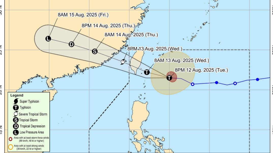
Typhoon Gorio slightly intensified as it continued moving west, according to the PAGASA late Thursday evening.
“As of 10 p.m., the center of the eye of Typhoon GORIO was estimated based on all available data at 300 km East Northeast of Itbayat, Batanes.” the state weather bureau said in its 11 p.m. advisory.
The typhoon was moving westward at 25 km/h.
“GORIO may make landfall over the eastern coast of southern Taiwan tomorrow (13 August) morning or afternoon and exit the Philippine Area of Responsibility (PAR) by tomorrow afternoon or evening. GORIO is forecast to intensify prior to its landfall to Taiwan before weakening throughout the remainder of the forecast period,” PAGASA added.
In terms of intensity, Gorio’s maximum sustained winds of 130 km/h near the center, gustiness of up to 160 km/h, and central pressure of 970 hPa.
Tropical Cyclone Wind Signal No.2 is in effect over Itbayat, Batanes while TCWS No. 1 was issued for the rest of the province.
Meanwhile, the enhanced Southwest Monsoon or Habagat will bring strong to gale-force gusts over the Babuyan Islands and the northern portion of mainland Cagayan, the eastern portion of Isabela, and the northern portion of Ilocos Norte.
A Gale Warning is in effect over the seaboard of Extreme Northern Luzon.
Up to very rough seas of up to nine meters will be experienced on the seaboards of Batanes.
PAGASA will issue the next tropical cyclone bulletin at 5:00 a.m. Wednesday. — RF, GMA Integrated News
