

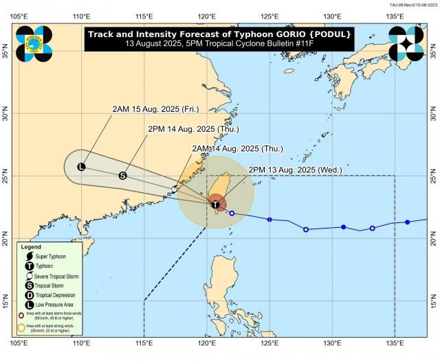
Gorio slightly weakens as it exits PAR
Typhoon Gorio has slightly weakened as it exited the Philippine Area of Responsibility, PAGASA said late Wednesday afternoon.
In its 5 p.m. bulletin, PAGASA said at 4 p.m., Gorio was located 325 km northwest of Itbayat, Batanes, and moving west northwestward at 25 km/h.
It has maximum sustained winds of 140 km/h and gustiness of up to 230 km/h.
“On the forecast track, Gorio will continue to move generally west northwestward for the entirety of the forecast period,” PAGASA said.
“Gorio is forecast to continue to weaken as it interacts with the terrain of Taiwan and mainland China,” it added.
Weather forecast
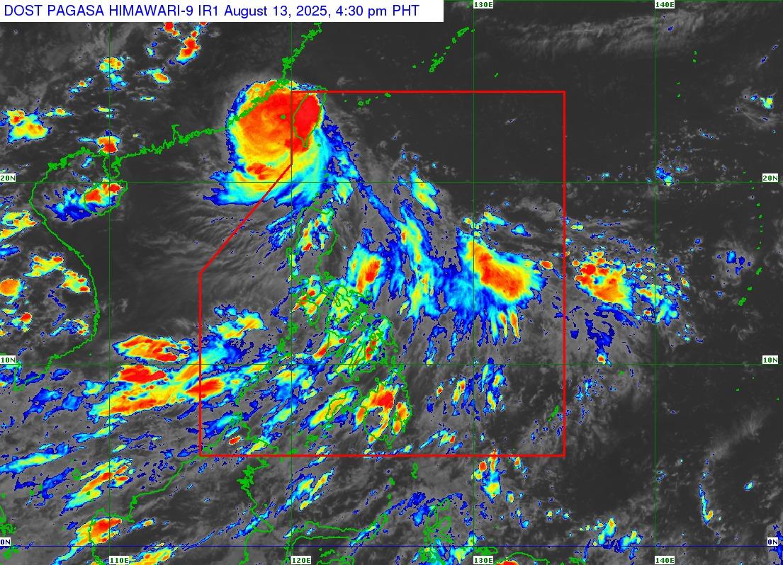
The typhoon will bring cloudy skies with scattered rains and thunderstorms over Batanes, Ilocos Norte, Apayao, and Cagayan.
The Southwest Monsoon will affect the weather conditions in MIMAROPA, Bicol Region, Visayas, Zamboanga Peninsula, BARMM, Northern Mindanao, CARAGA, Sultan Kudarat, Sarangani, and Davao Oriental.
Moderate to at times heavy rains may cause flash floods or landslides.
Meanwhile, Metro Manila and the rest of the country will experience partly cloudy to cloudy skies with isolated rain showers or thunderstorms due to localized thunderstorms.
Severe thunderstorms may trigger flash floods or landslides.
Winds will be moderate to strong, while coastal waters will be moderate to rough in extreme Northern Luzon.
The rest of Luzon will experience moderate wind and coastal water conditions.
Winds will be light to moderate, while coastal waters will be slight to moderate in Visayas and Mindanao.
Sunrise in Metro Manila will be at 5:42 a.m. on Thursday. —Mariel Celine Serquiña/VBL, GMA Integrated News
