

LPA inside PAR has ‘medium’ chance of turning into storm — PAGASA
The low pressure area (LPA) inside the Philippine Area of Responsibility (PAR) has a “medium” chance of developing into a tropical depression within the next 24 hours, PAGASA said Sunday afternoon.
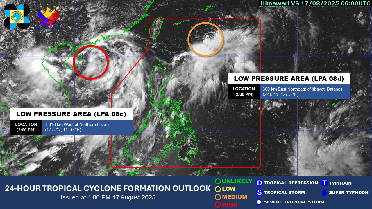
At 3 p.m., the LPA was located 585 kilometers east northeast of Itbayat, Batanes.
For now, its trough is expected to affect the weather conditions of Ilocos Region, Apayao, Cagayan, Zambales, and Bataan, according to the state weather bureau’s 4 p.m. weather forecast.
Cloudy skies with scattered rains and thunderstorms will persist over Metro Manila, Cavite, Batangas, Occidental Mindoro, and Palawan due to the Southwest Monsoon (Habagat).
Meanwhile, the rest of the country will see partly cloudy to cloudy skies with isolated rain showers or thunderstorms due to localized thunderstorms.
Residents of affected areas were warned against flash floods or landslides.
Meanwhile, the LPA observed outside PAR has a “high” chance of turning into a storm, PAGASA said
At 2 p.m., it was located at 1,010 km west of Northern Luzon.
State meteorologists also said the western sections of Luzon will experience moderate wind and coastal water conditions.
Winds will be light to moderate, while coastal waters will be slight to moderate throughout the rest of the country.
Sunrise in Metro Manila will be at 5:43 a.m. on Monday. — Mariel Celine Serquiña/RF, GMA Integrated News
