

LPA inside PAR has ‘medium’ chance of becoming tropical depression
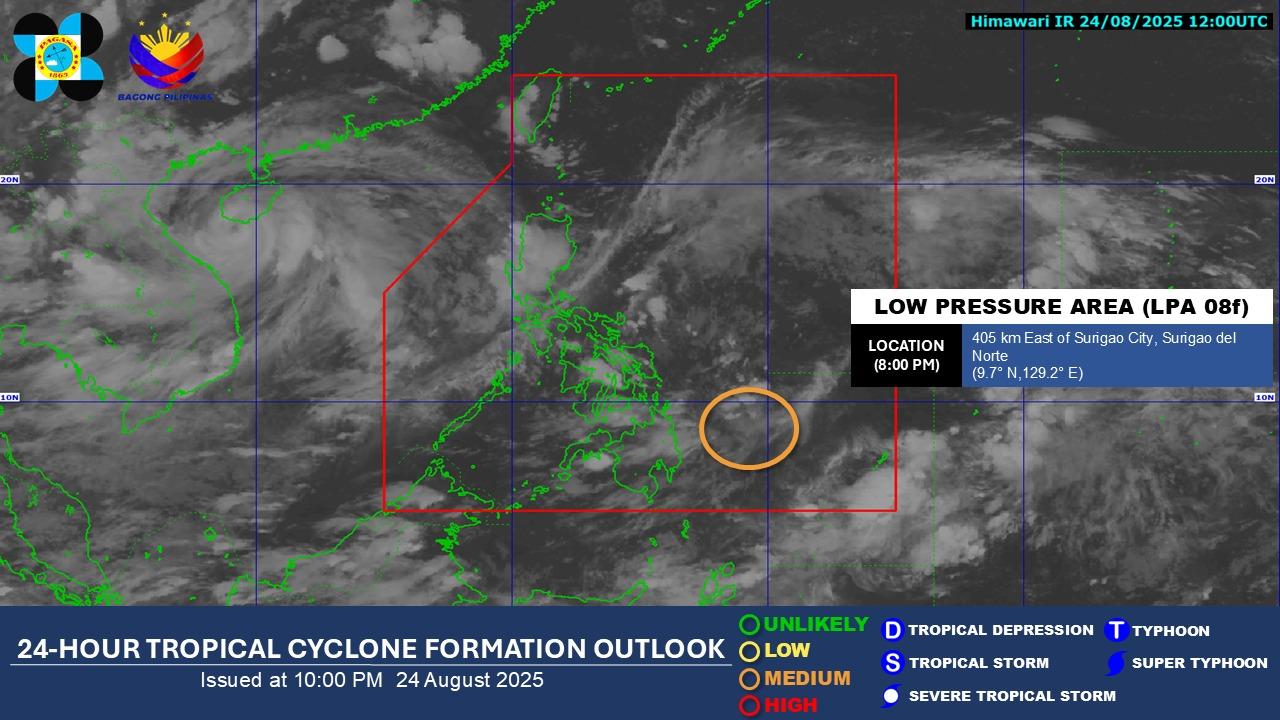
A low pressure area (LPA) being monitored inside the Philippine Area of Responsibility has a "medium" chance of developing into a tropical depression, PAGASA said Sunday evening.
In an 11 p.m. update, the state weather bureau said that the LPA, estimated as of 8 p.m. to be 405 kilometers east of Surigao City in Surigao del Norte, could become a topical depression at some point in the next 24 hours.
In a separate 11 p.m. weather advisory, PAGASA said that the some areas of the country could experience rainfall as a result of the LPA or the Southwest Monsoon or Habagat.
Due to the LPA, moderate to heavy rainfall (50-100 mm) is are forecast for the following areas from Sunday night to Monday evening:
- Albay
- Sorsogon
- Masbate
- Northern Samar
- Samar
- Eastern Samar
- Biliran
- Leyte
- Southern Leyte
- Dinagat Islands
Due to the Southwest Monsoon, 50-100 mm of rain are also forecast for the following areas from Monday evening to Tuesday evening:
- Occidental Mindoro
- Palawan
- Antique
Tropical Storm Isang, which exited the PAR on Saturday, has now left PAGASA's monitoring domain. Vietnam and China are now bracing for the storm, now known as Typhoon Kajiki. — BM, GMA Integrated News
