

Nando now a severe tropical storm —PAGASA
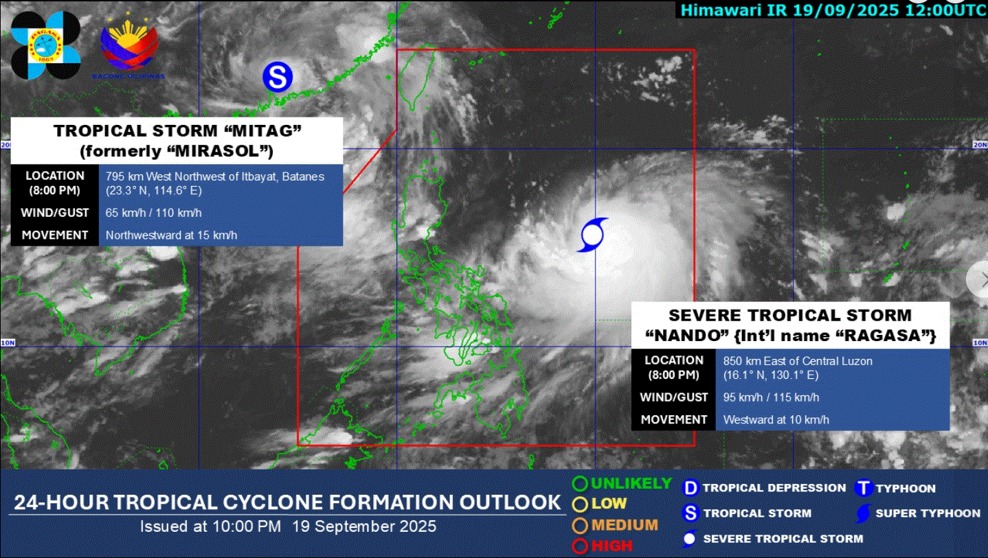
Tropical cyclone Nando has intensified into a severe tropical storm as of 8 p.m. Friday, according to PAGASA.
The weather bureau said it continues to monitor the weather disturbance inside the Philippine Area of Responsibility.
The center of Nando was estimated at 840 kilometers east of Central Luzon, moving westward at 10 kilometers per hour, with maximum sustained winds of 95 km/h near the center and gustiness of up to 115 km/h.
According to PAGASA's severe weather bulletin issued at 11 p.m. Nando may enhance the Southwest Monsoon as it approaches the landmass. Wind Signal No. 1 will be hoisted over Northern Luzon Saturday morning, it added.
Nando is forecast to move generally northwestward until Saturday before turning west northwestward towards extreme Northern Luzon.
"On the forecast track, the center of Nando may pass close or may make landfall over Batanes or Babuyan Islands in the afternoon or evening of September 22. It may exit PAR by Tuesday morning or afternoon.
PAGASA said the southwest monsoon and the trough of Nando will bring strong to gale-force gusts over the following areas (especially in coastal and upland areas exposed to winds):
- Saturday (20 September): Bicol Region, Eastern Visayas, and Caraga
- Sunday (21 September): Zambales, Bataan, CALABARZON, Bicol Region, MIMAROPA, Visayas, Northern Mindanao, and Caraga
- Monday (22 September): Zambales, Bataan, CALABARZON, Bicol Region, MIMAROPA, Visayas, Northern Mindanao, Caraga, and Davao Occidental
Coastal waters
For its 24-hour sea condition outlook, up to moderate seas of up to 2.5 meters are expected in the eastern seaboards of Batanes, Cagayan, including Babuyan Islands, Isabela, and Catanduanes.
"Mariners of motorbancas and similarly-sized vessels are advised to take precautionary measures while venturing out to sea and, if possible, avoid navigation under these conditions," PAGASA said.
State weather forecasters warned the public of possible hazards and reminded them to prepare for the expected impact of Nando, which may reach the super typhoon category by Monday.
“As early as now ay kumilos na. Make sure na ligtas ang kanilang mga tahanan at sundin ang maaaring aksyon na ipapairal ng kanilang mga lokal na leaders para maibsan, ma-minimize ang impacts nitong Nando,” PAGASA administrator Dr. Nathaniel Servando said at a press conference.
(As early as now, it has moved. Make sure all are safe and follow instructions from our local leaders to minimize the impact of Nando.)
“Ito'y may dala (na) panganib muli dahil sa malakas na hangin at malakas na pag-ulan na magdulot ng mga pagbaha, landslides, at storm surge sa mga dalampasigan,” he added.
(This brings danger due to its strong wind and heavy rainfall, which could cause floods, landslides, and storm surge in seashores.)
Meanwhile, PAGASA said Tropical Storm "Mitag" (formerly "Mirasol") is still being monitored outside PAR.—LDF, GMA Integrated News
