

TD expected to enter PAR Tuesday afternoon, to be named 'Opong'
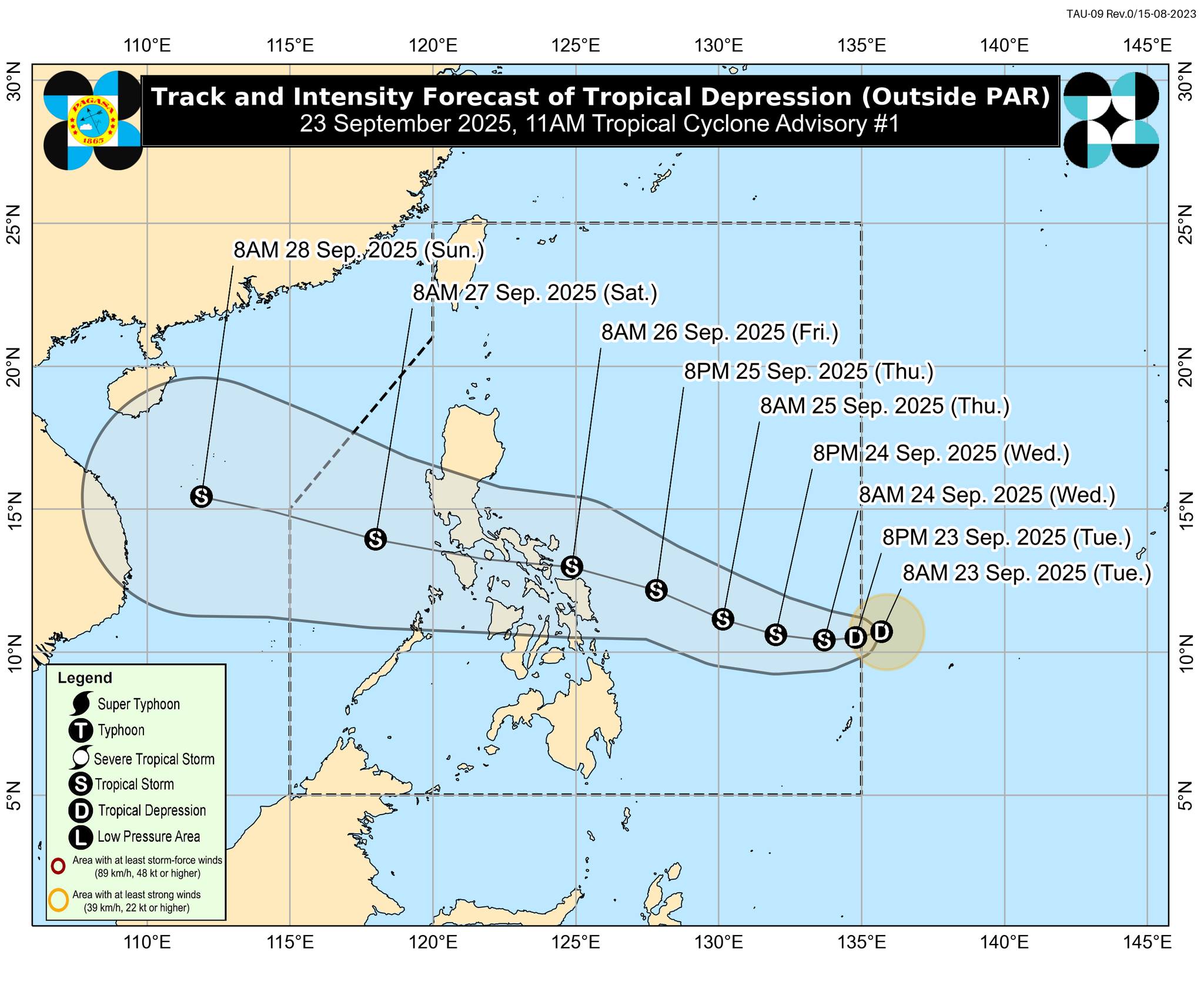
The Tropical Depression being monitored by PAGASA is expected to enter the Philippine Area of Responsibility by Tuesday afternoon and will be named 'Opong.'
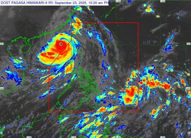
The Tropical Depression was last spotted 1,075 km East of Eastern Visayas with maximum sustained winds of 55 km/h near the center, gustiness of up to 70 km/h, and central pressure of 1006 hPa.
"The tropical depression (TD) is forecast to move generally westward for the next 36 hours and will enter the Philippine Area of Responsibility (PAR) this afternoon or evening and will be given a local name “OPONG,”" PAGASA said in its 11 a.m. advisory.
PAGASA added that the TD is expected to cross the Southern Luzon area.
"This weather disturbance will steadily intensify while over the Philippine Sea and may reach tropical storm category by tomorrow (24 September). Further intensification is not ruled out," added PAGASA.
Signal No. 2 may be hoisted over portions of Southern Luzon and Eastern Visayas, and Signal No. 3 in some areas is possible if the TD further intensifies, according to PAGASA.
Meanwhile, Signal No. 1 may be hoisted over Eastern Visayas as early as tomorrow.
The TD is expected to exit PAR by Saturday evening. —VAL, GMA Integrated News
