

PAGASA: Opong intensifies into tropical storm
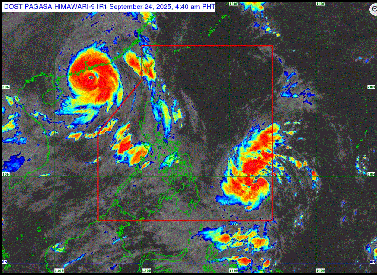
Tropical depression Opong, which is being monitored inside the Philippine Area of Responsibility, has intensified into a tropical storm, PAGASA said on Wednesday.
"Opong is less likely to directly affect the weather condition of the country in the next 24 hours. The onset of heavy rains due to Opong is possible by tomorrow, 25 September, onwards," it said in its cyclone bulletin.
PAGASA said Wind Signal No. 1 will be hoisted over northeastern Mindanao, Eastern Visayas, and Bicol Region within the day, and the highest Wind Signal that may be hoisted throughout its passage is Wind Signal No. 3, "considering that this tropical cyclone may reach severe tropical storm category."
Meanwhile, super typhoon Nando maintained its strength as it traversed the coastal waters south of China.
The weather bureau said Nando is forecast to move generally west northwestward approaching the waters south of mainland China. It may make landfall over southern China Wednesday afternoon or evening.
"Nando will begin to weaken due to marginally favorable environment over the waters south of mainland China and the increasing frictional effects due to proximity to land. Further weakening is expected post landfall this afternoon or evening," PAGASA added.
For the weather forecast on Wednesday, La Union, Pangasinan, Zambales, Bataan, Tarlac, Pampanga, and Occidental Mindoro are expected to experience occasional rains due to the Southwest Monsoon.
Metro Manila and the rest of Luzon will have cloudy skies with scattered rains and thunderstorms, also as a result of the Southwest Monsoon.
The Southwest Monsoon will also bring partly cloudy to cloudy skies with isolated rainshowers or thunderstorms to the Visayas and Zamboanga Peninsula.
The rest of Mindanao will have partly cloudy to cloudy skies with isolated rainshowers or thunderstorms brought by localized thunderstorms.
Sunrise is at 5:45 a.m. and sunset is at 5:51 p.m. —LDF, GMA Integrated News
